Category:Greater Los Angeles Area
Jump to navigation
Jump to search
large urban region in the United States     | |||||
| Upload media | |||||
| Instance of |
| ||||
|---|---|---|---|---|---|
| Location | California, Pacific States Region | ||||
| Population |
| ||||
| Different from | |||||
 | |||||
Subcategories
This category has the following 12 subcategories, out of 12 total.
Media in category "Greater Los Angeles Area"
The following 25 files are in this category, out of 25 total.
-
Map of the USA highlighting the Greater Los Angeles Area.gif 4,200 × 3,105; 1.53 MB
-
BajaltaCalif.jpg 2,246 × 1,433; 634 KB
-
California extended metropolitan areas locator map (gray).png 1,708 × 2,232; 807 KB
-
California geographical region county map.svg 621 × 733; 258 KB
-
Consulate General Los Angeles Skyline.jpg 4,032 × 2,268; 1.81 MB
-
-
Foothill Transit - Bus Number 486 to Cal-Poly State U.jpg 800 × 600; 255 KB
-
Greater Los Angeles Area.png 1,500 × 826; 424 KB
-
-
GreaterLAmap.png 1,000 × 1,000; 621 KB
-
ISS030-E-222910 - View of Earth.jpg 4,256 × 2,832; 748 KB
-
ISS048-E-23587 - View of Earth.jpg 4,928 × 3,280; 1.64 MB
-
ISS048-E-47528 - View of Earth.jpg 4,928 × 3,280; 1.74 MB
-
LA State Compensation Insurance Fund.jpg 1,053 × 1,374; 458 KB
-
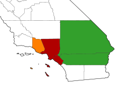
Los Angeles CSA urban areas.svg 1,022 × 600; 1.44 MB
-
Los Angeles CSA.svg 977 × 707; 253 KB
-
Los Angeles Freeway Map.png 583 × 482; 162 KB
-
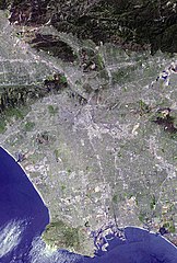
Los Angeles satellite map.jpg 576 × 854; 87 KB
-
Los Angeles tiny eddy.jpg 420 × 420; 56 KB
-
Los Angeles–Long Beach, CA CSA.png 1,217 × 2,163; 697 KB
-
Pacific Coast Highway, Greater LA.jpg 4,032 × 3,024; 2.77 MB
-
Santa Ana winds - satellite image.jpg 1,470 × 1,701; 327 KB
-
Santa Monica Bay Map.jpg 468 × 597; 283 KB
-
California SD-29 (2011).svg 1,450 × 1,680; 55 KB
-
Ywca logo.jpg 271 × 186; 7 KB