Category:Keage Incline
Jump to navigation
Jump to search
| Upload media | |||||
| Instance of | |||||
|---|---|---|---|---|---|
| Location | Sakyō-ku, Kyoto, Kyoto Prefecture, Japan | ||||
| Located in or next to body of water | |||||
| Service entry |
| ||||
| Service retirement |
| ||||
| Inception |
| ||||
| Dissolved, abolished or demolished date |
| ||||
| Width |
| ||||
| Length |
| ||||
 | |||||
Media in category "Keage Incline"
The following 63 files are in this category, out of 63 total.
-
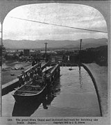
Biwa Canal and inclined railroad for hoisting the boats.jpg 570 × 640; 32 KB
-
Biwako Canal Keage, Kyoto, Japan 琵琶湖疏水蹴上船溜.JPG 3,106 × 2,346; 1.58 MB
-
Biwako incline.jpg 1,024 × 768; 544 KB
-
Biwako-IncLine.jpg 3,264 × 2,448; 4.19 MB
-
Building by keage incline.JPG 3,776 × 2,520; 3.92 MB
-
By the Keage incline (3477785204).jpg 2,336 × 3,504; 3.16 MB
-
Cherry blossoms at Keage Incline 01.jpg 1,343 × 1,916; 2.45 MB
-
Cherry blossoms at Keage Incline 02.jpg 1,376 × 1,964; 2.18 MB
-
Incline, Keage, Kyoto, Japan.JPG 3,265 × 2,511; 1.88 MB
-
Incline1.JPG 1,600 × 1,200; 545 KB
-
Inkurain cart.JPG 2,592 × 1,936; 2.16 MB
-
Keage (17106552148).jpg 4,600 × 3,067; 12.71 MB
-
Keage (17106555148).jpg 4,600 × 3,067; 10.18 MB
-
Keage (17106556588).jpg 4,600 × 3,067; 9.92 MB
-
Keage (17106558228).jpg 4,600 × 3,067; 11.56 MB
-
Keage (17106561598).jpg 4,600 × 3,067; 15.13 MB
-
Keage (17108113129).jpg 3,067 × 4,600; 9.03 MB
-
Keage (17292497032).jpg 4,600 × 3,067; 12.55 MB
-
Keage (17294330365).jpg 4,600 × 3,067; 10.48 MB
-
Keage incline (3476980907).jpg 3,504 × 2,336; 2.03 MB
-
Keage incline (3477787608).jpg 3,504 × 2,336; 2.82 MB
-
Keage Incline 20161116.jpg 5,184 × 3,456; 11.32 MB
-
Keage Incline 2022-10-11.jpg 6,048 × 4,024; 12.65 MB
-
Keage Incline Cable (North).JPG 3,264 × 2,448; 2.63 MB
-
Keage Incline Cable (South).JPG 3,264 × 2,448; 2.79 MB
-
Keage Incline Cable near Nanzenji Harbor.JPG 3,167 × 2,375; 3.22 MB
-
Keage Incline in 2019-04 ac.jpg 5,793 × 3,851; 5.02 MB
-
Keage Incline Nanzenji Funadamari, Kyoto, Japan 現役時代の琵琶湖疏水 蹴上インクライン 蹴上船溜.JPG 2,966 × 2,294; 1.11 MB
-
Keage Incline Spring 2021.jpg 2,048 × 1,536; 1.98 MB
-
Keage-IncLine Cenotaph.jpg 3,264 × 2,448; 5.04 MB
-
Keage-incline train in kyoto.jpg 1,536 × 2,048; 778 KB
-
KTO1804-048 (49764186777).jpg 3,648 × 5,472; 23.76 MB
-
KTO1804-049 (49763859921).jpg 5,472 × 3,648; 21.78 MB
-
KTO1804-050 (49764186767).jpg 5,472 × 3,648; 14.7 MB
-
KTO1804-051 (49764186837).jpg 5,472 × 3,648; 16.38 MB
-
KTO1804-052 (49763328298).jpg 3,648 × 5,472; 14.32 MB
-
KTO1804-053 (49764187017).jpg 5,472 × 3,648; 13.92 MB
-
KTO1804-054 (49763328318).jpg 4,711 × 3,141; 14.2 MB
-
KTO1804-055 (49763328368).jpg 5,472 × 3,648; 15.8 MB
-
KTO1804-056 (49763860391).jpg 5,472 × 3,648; 14.17 MB
-
KTO1804-057 (49764187247).jpg 4,398 × 2,932; 13.28 MB
-
KTO1804-058 (49763860366).jpg 3,648 × 5,472; 9.62 MB
-
KTO1804-059 (49763325368).jpg 5,472 × 3,648; 15.64 MB
-
KTO1804-060 (49763328643).jpg 5,472 × 3,648; 20.42 MB
-
KTO1804-073 (49764188182).jpg 5,472 × 3,648; 20.03 MB
-
KTO1804-074 (49764188242).jpg 3,648 × 5,472; 22.1 MB
-
Kyoto 20220827162334 (52650491450).jpg 4,032 × 3,024; 6.61 MB
-
Lake Biwa Canal (Kyoto) IMG 5471.JPG 2,448 × 3,264; 4.51 MB
-
Lake Biwa Canal (Kyoto) IMG 5588 a-10.JPG 2,448 × 3,264; 3.1 MB
-
Lake Biwa Canal (Kyoto) IMG 5588 a-2.JPG 3,264 × 2,448; 4.39 MB
-
Lake Biwa Canal (Kyoto) IMG 5588 a-3.JPG 2,448 × 3,264; 2.98 MB
-
Lake Biwa Canal Keage Incline.jpg 1,260 × 876; 500 KB
-
Lake Biwa Canal Museum of Kyoto IMG 5473 a-24.JPG 2,448 × 3,264; 3.71 MB
-
Nannzen-ji Funadamari.webm 42 s, 1,920 × 1,080; 12.67 MB
-
Walking Keage Incline.webm 2 min 12 s, 1,920 × 1,080; 51.18 MB
-
インクライン - panoramio (1).jpg 3,072 × 2,304; 2.3 MB
-
インクライン - panoramio (2).jpg 2,950 × 2,212; 1.87 MB
-
インクライン - panoramio (3).jpg 2,304 × 3,072; 3.23 MB
-
インクライン - panoramio.jpg 3,072 × 2,304; 2.32 MB
-
夏の日のインクライン.JPG 3,840 × 2,160; 2.84 MB
-
桜吹雪 Sakurafubuki (13646441864).jpg 4,119 × 2,746; 10.99 MB
-
蹴上 Keage (13646441354).jpg 5,472 × 3,648; 15.02 MB


