Category:Landschaftsschutzgebiet Rheingebiet von Bingen bis Koblenz
Jump to navigation
Jump to search
| Diese Kategorie repräsentiert ein Schutzgebiet nach Naturschutzrecht in Deutschland. |
|---|
| Diese Kategorie wurde nach einem klaren Schema angelegt, sie sollte nicht verschoben, gelöscht oder umkategorisiert werden. Sie ist unter anderem in dieser Uploadkarte hinterlegt. Beschreibung und Hintergründe auf der Seite des Wikiprojekts |
| Foto zu Wiki Loves Earth hochladen! - Seite von Wiki Loves Earth Deutschland |
protected landscape area in Rheinland-Pfalz, Germany | |||||
| Upload media | |||||
| Instance of | |||||
|---|---|---|---|---|---|
| Location | |||||
| Applies to jurisdiction | |||||
| IUCN protected areas category | |||||
| Inception |
| ||||
| Area |
| ||||
 | |||||
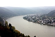
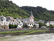
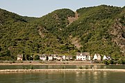
Deutsch: Landschaftsschutzgebiet „Rheingebiet von Bingen bis Koblenz“ (Nr. 07-LSG-71-1), landkreisübergreifendes LSG in Rheinland-Pfalz
Subcategories
This category has the following 15 subcategories, out of 15 total.
B
- Burg Stahlberg (22 F)
G
- Gründelbachtal (4 F)
K
L
M
R
- Rhine in Dörscheid (1 F)
- Rhine in Oberwesel (104 F)
S
T
- Tierpark Rheinböllen (47 F)
Media in category "Landschaftsschutzgebiet Rheingebiet von Bingen bis Koblenz"
The following 198 files are in this category, out of 198 total.
-
2003-04-18 St. Goar am Rhein.jpg 1,024 × 768; 751 KB
-
20090826BadSalzig.JPG 2,816 × 2,112; 2.77 MB
-
2011 GoetheSchiffBurgReichensteinTrechtigshausen.jpg 3,648 × 2,736; 2.74 MB
-
2014.06.21.185331 View St. Goar-Oberwesel Rhine Kaub B42.jpg 1,920 × 1,280; 734 KB
-
2016 Loreley 01.jpg 5,184 × 3,456; 5.76 MB
-
2016 Loreley 02.jpg 4,843 × 3,229; 4.96 MB
-
2016 Loreley 03.jpg 5,184 × 3,456; 6.79 MB
-
2016 Loreley 04.jpg 5,184 × 3,456; 5.44 MB
-
2016 Loreley 05.jpg 5,038 × 3,359; 5.07 MB
-
Amadeus Rhapsody (ship, 1998) 002.jpg 2,048 × 1,536; 3.54 MB
-
Auenlandschadt Bingerbrück 246-47-fLh.jpg 2,430 × 1,223; 859 KB
-
Ausblick Rheinfels.jpg 3,906 × 2,602; 4.97 MB
-
Ausblick von der Hindenburghöhe ins Rheintal.jpg 6,641 × 3,000; 14.4 MB
-
Aussicht vom Spitznack.jpg 5,452 × 2,000; 9.57 MB
-
Bacharach Farming.jpg 3,985 × 5,993; 8.49 MB
-
Bacharach Luftbild 01.jpg 2,861 × 1,594; 2.09 MB
-
Bacharach Luftbild 092.jpg 3,008 × 2,000; 4.16 MB
-
Bacharach vineyard Rhine Valley Germany.jpg 800 × 600; 161 KB
-
Bacharach vineyard tower.jpg 1,280 × 960; 204 KB
-
Bacharach, Ortsansicht vom rechten Rheinufer-002.jpg 4,928 × 3,264; 10.87 MB
-
Bacharach.jpg 2,872 × 2,154; 714 KB
-
Bacharach09.JPG 3,072 × 2,304; 3.13 MB
-
Badenhard01.jpg 2,033 × 691; 786 KB
-
Bararach1.jpg 1,024 × 768; 357 KB
-
Bingen 2009-08-06 00.jpg 3,888 × 2,592; 776 KB
-
Bingen 2009-08-06 01.jpg 3,888 × 2,592; 1.64 MB
-
Bingen 2009-08-06 02.jpg 3,888 × 2,592; 1.21 MB
-
Binger Loch 2011 2.JPG 4,000 × 3,000; 3.61 MB
-
Binger Loch.JPG 1,536 × 1,024; 1.14 MB
-
Bingerbrueck.jpg 3,008 × 2,000; 1.51 MB
-
Blick auf den Rhein und St. Goar.jpg 3,906 × 2,602; 5.02 MB
-
Braubach, Blick von der Marksburg nach Brey.jpg 4,272 × 2,848; 3 MB
-
Braubach, Blick von der Marksburg nach Spay.jpg 4,272 × 2,848; 3.03 MB
-
Brey und Rhens am Rhein.jpg 13,102 × 4,918; 25.39 MB
-
Buga 2011 Koblenz - Schloss Stolzenfels 06-2010.jpg 3,332 × 2,500; 2.08 MB
-
Burg Fürstenberg 2009-08-01 00.jpg 1,800 × 1,200; 331 KB
-
Burg Fürstenberg 2009-08-01 01.jpg 1,800 × 1,200; 257 KB
-
Burg Fürstenberg 2009-08-01 02.jpg 3,888 × 2,592; 770 KB
-
Burg Fürstenberg 2009-08-01 03.jpg 1,800 × 1,200; 218 KB
-
Burg Fürstenberg 2009-08-01 04.jpg 3,888 × 2,592; 1.58 MB
-
Burg Fürstenberg 2009-08-01 05 pregamma 0.6 reinhard02 key 0.28 phi 6.jpg 3,072 × 2,048; 551 KB
-
Burg Katz 001.jpg 3,906 × 2,602; 5.37 MB
-
Burg Katz u. Sankt Goar.JPG 3,264 × 2,448; 6.16 MB
-
Burg Loreley.JPG 2,048 × 1,536; 3.5 MB
-
Burg Maus, Skt Goarshausen (8494157615).jpg 3,568 × 2,368; 7.81 MB
-
Burg Rheinfels (adjusted).JPG 4,263 × 2,810; 10.01 MB
-
Burg Rheinfels - Flickr - tm-md (24).jpg 2,047 × 1,356; 506 KB
-
Burg Rheinfels - Flickr - tm-md (28).jpg 2,047 × 1,356; 668 KB
-
Burg Rheinfels - Flickr - tm-md (35).jpg 2,047 × 1,356; 611 KB
-
Burg Rheinfels - Flickr - tm-md (43).jpg 2,047 × 1,356; 721 KB
-
Burg Rheinfels - Flickr - tm-md (44).jpg 2,047 × 1,356; 692 KB
-
Burg Rheinfels - Flickr - tm-md (45).jpg 2,047 × 1,356; 776 KB
-
Burg Rheinfels - Flickr - tm-md (46).jpg 2,047 × 1,356; 810 KB
-
Burg Rheinfels - Flickr - tm-md (7).jpg 2,047 × 1,356; 321 KB
-
Burg rheinfels 2004.jpg 1,280 × 750; 643 KB
-
Burg Rheinfels Luftbild 02.jpg 1,618 × 1,647; 1.62 MB
-
Burg Rheinfels Luftbild 090.jpg 3,008 × 2,000; 4.05 MB
-
Burg Rheinfels, 2.jpg 4,611 × 2,276; 6.42 MB
-
Burg Rheinfels-04-Aussicht Uhrturm.jpg 4,253 × 3,190; 5.87 MB
-
Burg Rheinfels.JPG 4,263 × 2,810; 10.21 MB
-
Burg Rheinstein und Schweizerhaus am Rhein.JPG 4,928 × 3,264; 13.38 MB
-
Burg Sooneck (15120974254).jpg 4,912 × 3,264; 12.57 MB
-
Burg Sooneck Luftbild 01.jpg 2,066 × 1,795; 1.86 MB
-
Burg-Fuerstenberg-JR-E-921-2011-10-01.jpg 3,782 × 2,584; 7.33 MB
-
Burg-Loreley.jpg 1,975 × 1,459; 1.35 MB
-
Burg-Sooneck-JR-E-852-2011-09-14.jpg 2,870 × 2,870; 4.36 MB
-
BurgFuerstenbergRheindiebach-01s.jpg 1,408 × 1,056; 377 KB
-
BurgRheinfels01.jpg 1,016 × 570; 348 KB
-
BurgRheinfels02.jpg 2,592 × 1,944; 2.11 MB
-
Damscheid01.jpg 1,982 × 921; 1 MB
-
Dellhofen01.jpg 2,021 × 877; 980 KB
-
Die Dohle.jpg 1,910 × 1,224; 531 KB
-
Doerscheid-ortsansicht.jpg 460 × 257; 27 KB
-
Doerscheid-von-Bornich-aus.jpg 1,620 × 960; 119 KB
-
DoerscheidWestansicht.JPG 1,598 × 1,066; 604 KB
-
Ehrenthaler Hahn.JPG 3,888 × 2,592; 7.92 MB
-
Eisvogel, LSG Rheingebiet von Bingen bis Koblenz.jpg 3,508 × 2,480; 3.72 MB
-
Engehöll, Blick von der Kapelle zur Schönburg.jpg 5,104 × 3,716; 14.11 MB
-
Engehöll, Tal und Schönburg.jpg 5,380 × 3,460; 12.38 MB
-
Felsen auf dem Spitzenstein.jpg 4,626 × 3,000; 11.42 MB
-
Festungsruine Rheinfels, Sankt Goar (9947883803).jpg 3,505 × 2,326; 2.87 MB
-
Fleckertshöhe mit Rheintal.jpg 4,000 × 3,000; 4.82 MB
-
Fünfseenblick.jpg 19,465 × 2,000; 28.93 MB
-
Fürstenberg 13.JPG 1,024 × 1,536; 649 KB
-
GOARSHSX.jpg 640 × 417; 204 KB
-
Graureiher flug.jpg 3,872 × 2,592; 6.16 MB
-
GrubeGuteHoffnungAequivalenzstollenWellmich.JPG 3,648 × 2,736; 4.22 MB
-
Gründelbach01.jpg 1,536 × 2,048; 1.96 MB
-
Hirzenach - de Rijn bij Hirzenach.jpg 4,928 × 3,264; 7.9 MB
-
Hirzenach mit St. Bartolomäus.jpg 4,000 × 3,000; 4.2 MB
-
Hirzenach-Nord.jpg 3,072 × 2,048; 2.7 MB
-
Hunsrückbahn Mai.jpg 3,264 × 2,448; 4.88 MB
-
Img20050115 0002 de werlau.jpg 1,600 × 1,200; 368 KB
-
Kamp-Bornhofen2.jpg 845 × 577; 311 KB
-
Kandrich07.JPG 3,072 × 2,304; 2.56 MB
-
Karbach01.jpg 2,800 × 1,047; 497 KB
-
Karbach02.jpg 2,747 × 1,377; 903 KB
-
Kestert 000001.JPG 1,600 × 1,200; 868 KB
-
Kestert Rheinschleife 2015-06-07 13.38.21.jpg 2,337 × 2,298; 4.36 MB
-
Kestert081110.JPG 4,000 × 3,000; 7.63 MB
-
Koblenz, Schloss Stolzenfels (14638616312).jpg 3,568 × 2,368; 7.82 MB
-
Kormoranflug.jpg 4,878 × 3,199; 7.11 MB
-
Kribbe kaub.JPG 2,134 × 2,848; 2.73 MB
-
Lorchblick.JPG 2,048 × 1,536; 1.62 MB
-
Loreley-Statue sankt Goarshausen 2023-05-02 2.jpg 5,120 × 2,448; 3.69 MB
-
Loreley-Statue sankt Goarshausen 2023-05-02 5.jpg 3,648 × 1,744; 2.18 MB
-
Marksburg, Rhein.jpg 7,112 × 4,035; 10.53 MB
-
Mittelrhein - Flickr - tm-md (2).jpg 2,047 × 1,356; 564 KB
-
Mittelrhein - Flickr - tm-md (3).jpg 2,047 × 1,356; 478 KB
-
Mittelrhein - Flickr - tm-md (4).jpg 2,047 × 1,356; 357 KB
-
Mittelrhein - Flickr - tm-md (5).jpg 2,047 × 1,356; 427 KB
-
Mittelrhein Impressionen - Flickr - tm-md (1).jpg 2,047 × 1,356; 437 KB
-
Mittelrhein Impressionen - Flickr - tm-md (2).jpg 2,047 × 1,356; 295 KB
-
Mittelrhein Impressionen - Flickr - tm-md (3).jpg 2,047 × 1,356; 522 KB
-
Mittelrhein Impressionen - Flickr - tm-md (7).jpg 2,047 × 1,356; 340 KB
-
Mittelrhein Impressionen - Flickr - tm-md (8).jpg 2,047 × 1,356; 409 KB
-
Mittelrhein Impressionen - Flickr - tm-md.jpg 2,047 × 1,356; 461 KB
-
Mittelrheintal mit Burg Maus und der Ortschaft Wellmich (13810081474).jpg 3,351 × 2,213; 7.87 MB
-
MK38575 Schönburg (Oberwesel).jpg 2,981 × 1,677; 2.51 MB
-
Morgenbachtal.jpg 1,920 × 1,092; 2.58 MB
-
Mäuseturminsel, Nahemündung.jpg 1,600 × 1,200; 193 KB
-
Mühlenleyen.jpg 2,848 × 2,134; 1.28 MB
-
Niederheimbach04.JPG 3,072 × 2,304; 2.94 MB
-
Oberwesel (1967) 01.jpg 2,567 × 1,627; 2.25 MB
-
Oberwesel (1967) 02.jpg 2,542 × 1,667; 1.84 MB
-
Oberwesel Liebfrauenkirche 01.jpg 3,547 × 2,362; 3.76 MB
-
Oberwesel Niederbachstraße. Mühlentorturm am Niederbach.jpg 3,456 × 4,784; 12.71 MB
-
Oberwesel, Gelände an der grauen Lay.jpg 5,184 × 3,456; 10.21 MB
-
Oberwesel-Schönburg, Blick ins Engehölltal.jpg 5,184 × 3,456; 12.09 MB
-
Panorama Koblenz-Stolzenfels.jpg 7,659 × 2,000; 2.88 MB
-
Panorama Siebenburgenblick.jpg 24,271 × 4,000; 73.01 MB
-
Perscheid01.jpg 1,944 × 537; 549 KB
-
PulverturmGrubeGuteHoffnungWellmich.JPG 2,592 × 3,888; 4.25 MB
-
Radtour 2010 07 31 047.JPG 1,800 × 1,200; 423 KB
-
Rebhang am Oberweseler Oelsbergs.jpg 5,049 × 3,225; 13.98 MB
-
Rebstöcke, Oberweseler Oelsberg.jpg 3,456 × 5,184; 12.35 MB
-
Rhein 10.JPG 2,816 × 1,584; 1.97 MB
-
Rhein kaub 2023-05-02 1.jpg 3,648 × 1,744; 1.73 MB
-
Rhein kaub 2023-05-02 2.jpg 3,648 × 1,562; 1.25 MB
-
Rhein kaub 2023-05-02 3.jpg 3,648 × 1,744; 1.47 MB
-
Rhein kaub 2023-05-02 4.jpg 3,648 × 1,744; 1.76 MB
-
Rhein River Barge panorama.jpg 5,229 × 1,716; 1.37 MB
-
Rhein stgoar.jpg 3,906 × 2,602; 4.61 MB
-
Rhein ufer.jpg 3,906 × 2,602; 5.04 MB
-
Rheinburgenweg-Traumschleife-p01.jpg 4,875 × 3,464; 4.62 MB
-
Rheindiebach.jpg 6,000 × 4,000; 28.29 MB
-
Rheinfels Castle, St. Goar, Southeast view 20150514 1.jpg 6,957 × 4,348; 13.13 MB
-
Rheintal Burg Ehrenfels.jpg 2,548 × 2,880; 303 KB
-
Rheinufer in Sankt Goarhausen.jpg 3,647 × 2,429; 5.7 MB
-
Rhens1a.jpg 629 × 472; 50 KB
-
Rhine river - St Goar, Germany - panoramio.jpg 800 × 639; 233 KB
-
Rhine River near Sankt Goar.JPG 2,592 × 1,944; 1.69 MB
-
Rhine-near-Sankt-Goarshausen-JR-G6-4692-2010-06-05.jpg 3,020 × 2,217; 2.29 MB
-
RIMG0255.JPG 2,304 × 1,728; 1.68 MB
-
River Queen (ship, 1999) 004.jpg 1,966 × 1,226; 2.41 MB
-
Sankt Goar - Rhine from Hillside 2.JPG 2,592 × 1,944; 1.84 MB
-
Sankt Goar - Rhine River and Hills.JPG 1,944 × 2,592; 2.12 MB
-
Sankt Goar - Rhine River from Barge.JPG 2,592 × 1,944; 1.85 MB
-
SANKT GOARSHAUSEN - panoramio.jpg 2,816 × 2,112; 2.74 MB
-
Sankt Goarshausen 2023-05-02 1.jpg 3,281 × 1,568; 1.43 MB
-
Sankt Goarshausen 2023-05-02 10.jpg 5,120 × 2,448; 6.32 MB
-
Sankt Goarshausen 2023-05-02 2.jpg 3,648 × 1,744; 2.11 MB
-
Sankt Goarshausen 2023-05-02 3.jpg 5,120 × 2,448; 5.84 MB
-
Sankt Goarshausen 2023-05-02 4.jpg 3,648 × 1,744; 3.34 MB
-
Sankt Goarshausen 2023-05-02 5.jpg 3,648 × 1,744; 2.76 MB
-
Sankt Goarshausen 2023-05-02 6.jpg 5,120 × 2,448; 5.15 MB
-
Sankt Goarshausen 2023-05-02 7.jpg 3,648 × 1,744; 2.09 MB
-
Sankt Goarshausen 2023-05-02 8.jpg 5,120 × 2,448; 4.28 MB
-
Sankt Goarshausen 2023-05-02 9.jpg 3,648 × 1,744; 3.11 MB
-
Sankt goarshausen.jpg 1,200 × 900; 254 KB
-
Schwedenschanze Dörscheid.JPG 4,000 × 3,000; 4.21 MB
-
Schweizerhaus am Rhein.JPG 1,561 × 1,171; 604 KB
-
Sooneck01.jpg 1,248 × 899; 650 KB
-
Spay and Rhine aerial.jpg 2,616 × 3,488; 1.98 MB
-
St Goarshausen Ehrenthal Grube Gute Hoffnung.JPG 3,888 × 2,592; 2.07 MB
-
St goarshausen pano wv d s 08 2007 neu.jpg 2,694 × 900; 459 KB
-
St. Goar 003.jpg 3,888 × 2,592; 3.76 MB
-
Stadtmauer Oberwesel Anfang WSW.jpg 4,527 × 2,605; 4.63 MB
-
Stahlberg1.jpg 3,008 × 2,000; 1.67 MB
-
Stahlberg2.jpg 2,000 × 3,008; 2.1 MB
-
Steeg.JPG 2,592 × 1,944; 1.66 MB
-
StGH005.jpg 5,582 × 3,663; 22.53 MB
-
StGoarshausenEhrenthalAbraumhalde.JPG 3,121 × 2,153; 1.39 MB
-
Strauß-wackenberg-1.jpg 460 × 640; 78 KB
-
UNESCO Welterbe 'Mittelrheintal' - Schönburg Oberwesel (8503866238).jpg 3,204 × 2,051; 6.89 MB
-
UNESCO Welterbe Mittelrheintal; - Schönburg Oberwesel (8564353847).jpg 1,896 × 1,166; 2.34 MB
-
Utzenhain01.jpg 2,037 × 1,161; 1.59 MB
-
Vorspann.JPG 2,816 × 2,112; 2.58 MB
-
Wanderer auf dem Rheinsteig.jpg 1,800 × 1,350; 2.11 MB
-
Wappen von Köln, Hasseroder.jpg 2,048 × 1,536; 2.23 MB
-
Weiler-Bopparder Bach Höhe Am Weinberg 60.jpg 3,840 × 5,760; 14.03 MB
-
Weinsteinerleyen.jpg 2,848 × 2,134; 1.42 MB
-
Wellmich mit Maus.JPG 1,632 × 1,224; 923 KB
-
Wellmich-JR-G6-4797-2010-08-10.jpg 3,033 × 2,367; 2.67 MB
-
Wiebelsheim von suedwesten Maerz 2013.jpg 2,000 × 1,500; 1.83 MB
-
Wilhelm hofmann gymnasium sankt goarshausen.jpg 661 × 419; 98 KB
-
Ziehlay.jpg 1,360 × 1,024; 629 KB
Categories:
- Protected landscape areas in Koblenz
- Upper Middle Rhine Valley
- Protected landscape areas in Landkreis Bad Kreuznach
- Protected landscape areas in Landkreis Mayen-Koblenz
- Protected landscape areas in Rhein-Hunsrück-Kreis
- Protected landscape areas in Rhein-Lahn-Kreis
- Protected landscape areas in Landkreis Mainz-Bingen


