Category:Maps of Pontus
Jump to navigation
Jump to search
Wikimedia category | |||||
| Upload media | |||||
| Instance of | |||||
|---|---|---|---|---|---|
| Category combines topics | |||||
| Pontus | |||||
region in the eastern Black Sea Region of Turkey | |||||
| Instance of | |||||
| Location | Anatolia | ||||
| Different from | |||||
 | |||||
Subcategories
This category has the following 2 subcategories, out of 2 total.
M
P
- Ptolemy's 1st Asian Map (67 F)
Media in category "Maps of Pontus"
The following 87 files are in this category, out of 87 total.
-
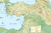
Roma in Oriente 62aC.png 2,425 × 1,581; 3.59 MB
-
Roma in Oriente 63aC.png 2,425 × 1,581; 3.6 MB
-
Roma in Oriente 64aC.png 2,425 × 1,581; 3.59 MB
-
Roma in Oriente 65aC.png 2,425 × 1,581; 3.6 MB
-
Roma in Oriente 66aC.png 2,425 × 1,581; 3.59 MB
-
Roma in Oriente 67aC.png 2,425 × 1,581; 3.54 MB
-
Roma in Oriente 68aC.png 2,425 × 1,581; 3.52 MB
-
Roma in Oriente 70-69aC.png 2,425 × 1,581; 3.53 MB
-
Roma in Oriente 73-71aC.png 2,425 × 1,581; 3.49 MB
-
Roma in Oriente 74aC.png 2,425 × 1,581; 3.47 MB
-
Mithridates in 88aC.png 2,425 × 1,581; 3.32 MB
-
1stMithritadicwar89BC-he.png 1,000 × 790; 257 KB
-
1stMithritadicwar89BC-pt.svg 1,501 × 1,186; 127 KB
-
1stMithritadicwar89BC-ru.svg 1,501 × 1,186; 508 KB
-
1stMithritadicwar89BC.png 791 × 625; 101 KB
-
Mithridates in 89aC.png 2,425 × 1,581; 3.32 MB
-
Roma in Oriente 92aC.png 2,425 × 1,581; 3.31 MB
-
Roma in Oriente 101aC.png 2,425 × 1,581; 3.32 MB
-
Roma in Oriente 129aC. (crop).png 1,055 × 1,171; 996 KB
-
Roma in Oriente 129aC.png 2,425 × 1,581; 3.3 MB
-
Asia minor Mithridates retouched.jpg 1,043 × 576; 321 KB
-
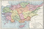
1907 map of Asia Minor-Atlas of Ancient and Classical Geography by Samuel Butler.jpg 3,170 × 2,072; 2.08 MB
-
1stMithritadicwar89BC - ar.svg 2,372 × 1,873; 661 KB
-
1stMithritadicwar89BC-es.svg 1,601 × 1,265; 1,021 KB
-
1stMithritadicwar89BC-grc.svg 1,501 × 1,186; 80 KB
-
1stMithritadicwar89BC-zh.svg 1,600 × 1,263; 516 KB
-
1stMithritadicwar89BC.svg 512 × 404; 771 KB
-
Alter Orient 0100BC-af.svg 2,102 × 1,510; 4.77 MB
-
Alter Orient 0100BC-es.svg 2,102 × 1,510; 3.84 MB
-
Alter Orient 0100BC.svg 2,102 × 1,510; 4.77 MB
-
Alter Orient 0200BC-es.svg 2,102 × 1,510; 3.64 MB
-
Alter Orient 0200BC.svg 2,102 × 1,510; 4.9 MB
-
Anatolia 264.jpg 823 × 513; 191 KB
-
Anatolian regions.png 625 × 379; 515 KB
-
Asia Minor in 281 BCE.png 1,073 × 559; 260 KB
-
Bithynia et Pontus (Imperium Romanum).png 2,495 × 1,775; 53 KB
-
Bosporus and Pontus MAP.png 768 × 576; 88 KB
-
Christians in the Black Sea region (1896).JPG 956 × 636; 67 KB
-
Dioecesis Pontica 400 AD Comana Pontica.png 835 × 333; 323 KB
-
Dioecesis Pontica 400 AD-pt.svg 835 × 333; 66 KB
-
Dioecesis Pontica 400 AD-zh.svg 1,044 × 416; 315 KB
-
Dioecesis Pontica 400 AD.png 835 × 333; 330 KB
-
Enosi Pontion Pierias, Karte.jpg 3,188 × 2,012; 1.48 MB
-
Flag map of Pontos.png 1,280 × 724; 125 KB
-
Heinrich Kiepert. Asia citerior.Pontus.jpg 2,584 × 1,381; 829 KB
-
Heinrich Kiepert. Imperia Persarum et Macedonum. 1903 (CA).jpg 1,283 × 653; 666 KB
-
Historical Lazona-Lazeti-Lazistan map.jpg 1,258 × 765; 1.05 MB
-
Imera Pontou location.png 513 × 236; 77 KB
-
Karte aus dem Buch Römische Provinzen von Theodor Mommsen 1921 16.png 6,704 × 3,547; 44.49 MB
-
Karte aus dem Buch Römische Provinzen von Theodor Mommsen 1921 16a.jpg 3,755 × 3,488; 8.98 MB
-
Karte aus dem Buch Römische Provinzen von Theodor Mommsen 1921 16a.png 3,755 × 3,488; 16.74 MB
-
Kromni Pontou location.png 513 × 236; 75 KB
-
Lazistan Haritası - Map of Lazistan.tif 5,262 × 3,366, 2 pages; 10.78 MB
-
Map of Pontos.PNG 2,500 × 2,053; 11.68 MB
-
Map of Pontus.jpg 3,289 × 2,122; 1.03 MB
-
Map of Pontus.png 640 × 290; 141 KB
-
P20 76 77 of 'Pomponii Melæ de situ orbis libri tres.jpg 2,888 × 2,236; 1.15 MB
-
Pont localisation.png 1,200 × 1,000; 79 KB
-
Pontic-650.jpg 1,218 × 1,344; 506 KB
-
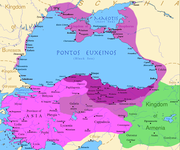
PonticKingdom.png 1,551 × 1,296; 265 KB
-
Pontisches Gebirge.png 900 × 431; 608 KB
-
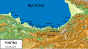
Pontos and southern Kolchis from Sinope to Phasis.png 2,500 × 543; 987 KB
-
PontosGreekColonies.jpg 1,160 × 760; 165 KB
-
Pontosmap el.svg 1,172 × 648; 247 KB
-
Pontosmap en.svg 1,172 × 648; 261 KB
-
Pontosmap.png 1,172 × 648; 1.22 MB
-
Pontus Armenia.jpg 1,220 × 1,046; 428 KB
-
Pontus.png 1,500 × 1,200; 1.2 MB
-
Reiaume de Pònt durant lo rèine de Mitridat VI.png 1,072 × 1,035; 230 KB
-
REmpire-Pontus.PNG 400 × 296; 41 KB
-
Republic of Pontus map.svg 760 × 491; 111 KB
-
Roman East 50 CE Commagene highlighted-en.svg 2,717 × 1,595; 854 KB
-
Roman East 50 CE Commagene highlighted-zh.svg 3,396 × 1,993; 2.7 MB
-
Roman East 50-ang.svg 2,717 × 1,595; 822 KB
-
Roman East 50-en.svg 2,717 × 1,595; 848 KB
-
Roman East 50-es.svg 2,717 × 1,595; 3.6 MB
-
Roman East 50-he.svg 2,717 × 1,595; 854 KB
-
Roman East 50-hu.svg 2,717 × 1,595; 858 KB
-
Roman East 50-pt.svg 2,717 × 1,595; 851 KB
-
Roman East 50-zh.svg 3,396 × 1,993; 2.68 MB
-
Stavrin Pontou location.jpg 512 × 234; 46 KB
-
Trabzon Vilayeti nüfus Ottoman population 1914.png 685 × 378; 48 KB


