Category:Maps of islands of Uruguay
Jump to navigation
Jump to search
Media in category "Maps of islands of Uruguay"
The following 9 files are in this category, out of 9 total.
-
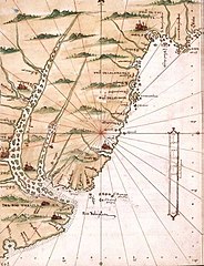
Chart of Maldonado and the Island of Gorriti (4232064562).jpg 2,000 × 1,665; 1.95 MB
-
IlhaBrasileira.png 825 × 794; 44 KB
-
-
Isla de Lobos - Gorriti UY.PNG 1,440 × 720; 48 KB
-
Isla martin garcia-timoteo dominguez 1.png 2,120 × 3,256; 210 KB
-
Isla martin garcia.png 456 × 695; 57 KB
-
Isla Timoteo Dominguez-Martin Garcia.png 1,058 × 1,374; 152 KB
-
Montevideo 1813-C.png 611 × 523; 302 KB
-
Rio de la plata- Alonso de Santa Cruz.jpg 499 × 650; 83 KB