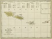
Category:Old maps of Samoa
Jump to navigation
Jump to search
Countries of Oceania: Australia · Fiji · Federated States of Micronesia · Kiribati · Marshall Islands · Nauru · New Zealand · Palau · Papua New Guinea · Samoa · Solomon Islands · Tonga · Tuvalu · Vanuatu
Other areas: Clipperton Island · Cook Islands · French Polynesia · Guam · Hawaii · New Caledonia · Niue · Northern Mariana Islands · Pitcairn Islands · Wallis and Futuna – Partly: British overseas territories · Indonesia · French Southern and Antarctic Lands
Other areas: Clipperton Island · Cook Islands · French Polynesia · Guam · Hawaii · New Caledonia · Niue · Northern Mariana Islands · Pitcairn Islands · Wallis and Futuna – Partly: British overseas territories · Indonesia · French Southern and Antarctic Lands
Use the appropriate category for maps showing all or a large part of Samoa. See subcategories for smaller areas:
| If the map shows | Category to use |
|---|---|
| Samoa on a recently created map | Category:Maps of Samoa or its subcategories |
| Samoa on a map created more than 70 years ago | Category:Old maps of Samoa or its subcategories |
| the history of Samoa on a recently created map | Category:Maps of the history of Samoa or its subcategories |
| the history of Samoa on a map created more than 70 years ago | Category:Old maps of the history of Samoa or its subcategories |
Subcategories
This category has the following 2 subcategories, out of 2 total.
Media in category "Old maps of Samoa"
The following 40 files are in this category, out of 40 total.
-
TURNER(1884) MAP OF SAMOA.jpg 1,983 × 1,171; 895 KB
-
A complete geography (1902) (14766772624).jpg 2,400 × 1,662; 799 KB
-
NIE 1905 Guam, U. S. and dependent territories.jpg 1,586 × 2,489; 1.22 MB
-
Meyers b14 s0260a.jpg 800 × 502; 109 KB
-
Admiralty Chart No 1339 North Coast of Upolu, Published 1900, New Edition 1915.jpg 11,050 × 8,085; 11.75 MB
-
Admiralty Chart No 1730 Samoa or Navigator Islands, South Pacific Ocean, Published 1886.jpg 16,281 × 11,168; 53.59 MB
-
Die Gartenlaube (1879) b 569.jpg 2,263 × 1,571; 474 KB
-
Die Gartenlaube (1889) b 274.jpg 1,133 × 586; 283 KB
-
German Map of Samoa, 1914 (39749569941).jpg 8,505 × 3,726; 7.02 MB
-
Journal des Museum Godeffroy BHL35399018.jpg 3,035 × 4,189; 1.03 MB
-
Map of Black Saturday, 28 December 1929, Samoa (28032474070).jpg 2,500 × 1,768; 3.65 MB
-
P150 - N° 551. Groupes des Fidji et des Samoa. - Liv4-Ch06.png 1,438 × 1,652; 668 KB
-
P277 - N° 564. Propriétés des Blancs aux îles Samoa. - Liv4-Ch08.png 1,446 × 1,004; 154 KB
-
PEIP(1910) Map of Manono Island, Samoa.jpg 673 × 412; 89 KB
-
PEIP(1910) Map of Matavanu Volcan, Samoa.jpg 440 × 551; 215 KB
-
PEIP(1910) Map of Sawaii Island, Samoa.jpg 965 × 594; 304 KB
-
PEIP(1910) Map of the Manu Islands, Samoa.jpg 2,481 × 1,141; 1.12 MB
-
PEIP(1910) Map of Tutuila Island, Samoa.jpg 2,486 × 1,364; 1.43 MB
-
PEIP(1910) Map of Upolu Island, Samoa.jpg 2,073 × 857; 972 KB
-
Plan de l'Archipel des Navigateurs.jpg 10,357 × 7,143; 10.23 MB
-
Samoa Cram Map 1896.jpg 2,165 × 1,621; 787 KB
-
Samoa. LOC 2003629356.jpg 2,505 × 3,279; 574 KB
-
Samoa. LOC 2003629356.tif 2,505 × 3,279; 23.5 MB
-
Sketch map Samoa in the Pacific.jpg 843 × 648; 104 KB
-
The Social and Political Systems of Central Polynesia - Upolu.png 9,730 × 4,031; 277 KB
-
Tutuila Locator.jpg 237 × 120; 32 KB
-
Upolu Locator.jpg 233 × 118; 31 KB
-
Upolu map, US Ex. Ex., 1839.jpg 8,102 × 6,041; 7.31 MB
-
Upolu.jpg 572 × 466; 60 KB
-
Voyage de La Pérouse autour du monde (No. 64) BHL15849702.jpg 10,082 × 6,819; 4.51 MB
-
Wallis, Futuna, Niuas islands on a 1797 French map.jpg 960 × 626; 230 KB
-
Western Samoa- Administrative divisions. 6-70. LOC gm71002081.jpg 4,212 × 3,049; 871 KB
-
Western Samoa- Administrative divisions. 6-70. LOC gm71002081.tif 4,212 × 3,049; 36.74 MB
-
Western Samoa. LOC 91682541.jpg 2,135 × 2,916; 627 KB
-
Western Samoa. LOC 91682541.tif 2,135 × 2,916; 17.81 MB
-
Western Samoa. LOC 93682293.jpg 3,177 × 4,165; 1.11 MB
-
Western Samoa. LOC 93682293.tif 3,177 × 4,165; 37.86 MB


