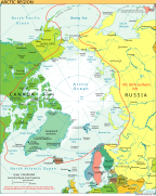
Category:SVG maps of the Arctic
Jump to navigation
Jump to search
Subcategories
This category has only the following subcategory.
S
Media in category "SVG maps of the Arctic"
The following 66 files are in this category, out of 66 total.
-
Arctic (orthographic projection with highlights).svg 512 × 512; 412 KB
-
Arctic (orthographic projection).svg 553 × 553; 329 KB
-
Arctic circle mk.svg 505 × 633; 2.75 MB
-
Arctic circle.svg 505 × 633; 1.63 MB
-
Arctic de.svg 1,049 × 1,301; 3.58 MB
-
Arctic hi.svg 505 × 633; 1.47 MB
-
Arctic lt.svg 505 × 633; 1.5 MB
-
Arctic Ocean Currents.svg 3,409 × 3,387; 752 KB
-
Arctic Ocean location map 2.svg 708 × 708; 466 KB
-
Arctic Ocean location map.svg 709 × 708; 589 KB
-
Arctic Routes (RUS).svg 1,010 × 1,267; 1.46 MB
-
Arctic-es.svg 505 × 633; 1.54 MB
-
Arctic-fr.svg 505 × 633; 1.59 MB
-
Arctic-hr.svg 505 × 633; 1.46 MB
-
Arctic-mk.svg 505 × 633; 1.52 MB
-
Arctic-sr.svg 505 × 633; 1.51 MB
-
Arctic.svg 505 × 633; 1.5 MB
-
Arktika-hsb.svg 505 × 633; 1.59 MB
-
Baffin Island location map.svg 600 × 400; 530 KB
-
Blank Franz Joseph Land.svg 850 × 400; 159 KB
-
Boundaries in the Arctic - map-de.svg 1,335 × 1,335; 943 KB
-
Boundaries in the Arctic - map-fr.svg 1,335 × 1,335; 969 KB
-
Boundaries in the Arctic - map-sv.svg 1,335 × 1,335; 980 KB
-
Desglaç artic.svg 807 × 1,026; 126 KB
-
Franz Josef Land location-de.svg 507 × 470; 58 KB
-
Franz Josef Land location-en.svg 507 × 470; 57 KB
-
Franz Josef Land location-es.svg 507 × 470; 61 KB
-
Franz Josef Land location-hu.svg 507 × 470; 68 KB
-
Franz Josef Land location-ru.svg 507 × 470; 58 KB
-
Franz Josef Land location-zh.svg 507 × 470; 58 KB
-
Kara Sea map hr.svg 1,004 × 915; 296 KB
-
Lancasteri väin.svg 407 × 394; 245 KB
-
Map of central Franz Josef Land-en.svg 362 × 523; 346 KB
-
Map of Franz Josef Land-de.svg 1,289 × 862; 719 KB
-
Map of Franz Josef Land-en.svg 1,289 × 862; 719 KB
-
Map of Franz Josef Land-es.svg 1,289 × 862; 726 KB
-
Map of Franz Josef Land-hu.svg 1,289 × 862; 779 KB
-
Map of Franz Josef Land-mk.svg 1,289 × 862; 1.8 MB
-
Map of Franz Josef Land-ru.svg 1,289 × 862; 709 KB
-
Map of Graham Bell Island and Wilczek Land-en.svg 451 × 565; 103 KB
-
Map of Southeastern Franz Josef Land-en.svg 513 × 397; 344 KB
-
Map of the Russian Extreme North.svg 1,092 × 630; 399 KB
-
Map of Western Franz Josef Land-en.svg 429 × 472; 323 KB
-
Nansen Fram Expedition map-fr.svg 1,000 × 600; 70 KB
-
Nansen Fram Map af.svg 1,003 × 601; 103 KB
-
Nansen Fram Map-de.svg 1,003 × 601; 177 KB
-
Nansen Fram Map-no.svg 1,003 × 601; 175 KB
-
Nansen Fram Map.svg 1,003 × 601; 183 KB
-
Nansen Franz Josef Land voyage map-de.svg 600 × 438; 239 KB
-
Nansen Franz Josef Land voyage map-fr.svg 599 × 437; 200 KB
-
Nansen Franz Josef Land voyage map.svg 600 × 438; 400 KB
-
Nansen's Planned Drift map-fr.svg 1,335 × 1,335; 1.94 MB
-
Sea ice.svg 706 × 705; 117 KB
-
Norwegian Arctic Expedition (1898—1902) map-ru.svg 1,731 × 1,521; 787 KB
-
Outline Map of Franz Josef Land.svg 360 × 256; 618 KB
-
Sea-ice-2013-en.svg 1,200 × 1,201; 2.05 MB
-
Supposed Route of Franklin's expedition 1845-1848 DE.svg 999 × 700; 1.73 MB
-
Topographic map of Svalbard de.svg 2,497 × 2,537; 1.4 MB
-
Topographic map of Svalbard lv.svg 2,497 × 2,537; 1.37 MB
-
Topographic map of Svalbard ru.svg 2,497 × 2,537; 4.58 MB
-
Topographic map of Svalbard uk.svg 2,497 × 2,537; 4.61 MB
-
Topographic map of Svalbard.svg 2,497 × 2,537; 1.56 MB
-
Worldmap northern.svg 553 × 553; 589 KB
-
Реки Таймыра, названные Константином Петровым.svg 512 × 594; 313 KB
-
سرزمین شمالگان.svg 1,010 × 1,267; 1.5 MB
-
مدار شمالگان.svg 1,010 × 1,267; 1.49 MB


