File:Jade-weser-muendung map de.svg
Jump to navigation
Jump to search

Size of this PNG preview of this SVG file: 646 × 600 pixels. Other resolutions: 259 × 240 pixels | 517 × 480 pixels | 827 × 768 pixels | 1,103 × 1,024 pixels | 2,206 × 2,048 pixels | 1,483 × 1,377 pixels.
Original file (SVG file, nominally 1,483 × 1,377 pixels, file size: 617 KB)
Captions
Captions
Add a one-line explanation of what this file represents
Summary
[edit]| Description |
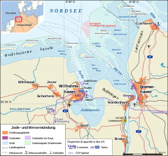
Deutsch: Übersichtskarte Jade- und Wesermündung |
|||
| Date | ||||
| Source |
Own work (Original text: self-made) |
|||
| Author | Alexrk | |||
| Other versions |
[]
|
|||
| SVG development |
|


Licensing
[edit]Alexrk, the copyright holder of this work, hereby publishes it under the following license:
This file is licensed under the Creative Commons Attribution-Share Alike 3.0 Unported license.
Attribution: Alexrk
- You are free:
- to share – to copy, distribute and transmit the work
- to remix – to adapt the work
- Under the following conditions:
- attribution – You must give appropriate credit, provide a link to the license, and indicate if changes were made. You may do so in any reasonable manner, but not in any way that suggests the licensor endorses you or your use.
- share alike – If you remix, transform, or build upon the material, you must distribute your contributions under the same or compatible license as the original.
File history
Click on a date/time to view the file as it appeared at that time.
| Date/Time | Thumbnail | Dimensions | User | Comment | |
|---|---|---|---|---|---|
| current | 17:25, 12 April 2008 | 1,483 × 1,377 (617 KB) | Alexrk (talk | contribs) | Windpark Nordergründe, AKW Unterweser | |
| 23:44, 27 March 2008 | 1,483 × 1,377 (602 KB) | Alexrk (talk | contribs) | Wesermündung in Küstenlinie aufgenommen | ||
| 19:29, 27 March 2008 | 1,483 × 1,377 (577 KB) | Alexrk (talk | contribs) | |||
| 18:57, 27 March 2008 | 1,483 × 1,377 (577 KB) | Alexrk (talk | contribs) | Korrekturen, Bahnlinien, Elb-Fahrwasser, Grenzen HH | ||
| 22:44, 26 March 2008 | 1,483 × 1,377 (550 KB) | Alexrk (talk | contribs) | Ölleitungen und Speicher | ||
| 14:12, 26 March 2008 | 1,483 × 1,377 (517 KB) | Alexrk (talk | contribs) | |||
| 14:06, 26 March 2008 | 1,483 × 1,377 (509 KB) | Alexrk (talk | contribs) | |||
| 14:03, 26 March 2008 | 1,483 × 1,377 (473 KB) | Alexrk (talk | contribs) | Reverted to version as of 14:59, 24 March 2008 | ||
| 14:02, 26 March 2008 | 1,483 × 1,377 (509 KB) | Alexrk (talk | contribs) | Reverted to version as of 13:51, 25 March 2008 | ||
| 14:00, 26 March 2008 | 1,483 × 1,377 (517 KB) | Alexrk (talk | contribs) |
You cannot overwrite this file.
File usage on Commons
The following 9 pages use this file:
File usage on other wikis
The following other wikis use this file:
- Usage on azb.wikipedia.org
- Usage on de.wikipedia.org
- Bremerhaven
- Jadebusen
- Nordenham
- JadeWeserPort
- Mellum
- Langlütjen
- Bremer Häfen
- Norddeutsche Oelleitung
- Nord-West Oelleitung
- Knechtsände
- Hoher Knechtsand
- Großer Knechtsand
- Wilhelmshaven
- Wikipedia:Kartenwerkstatt/Archiv/2008-03
- Wilhelmshavener Häfen
- Leuchtturm Hohe Weg
- Werften an der Unterweser
- Kavernenanlage Etzel
- Innenjade
- Butjadingen (Landschaft)
- Ölunfall in Ostfriesland 2013
- Benutzer:Aeroid/List DE NI Immediate
- Salzstock Rüstringen
- Usage on es.wikipedia.org
- Usage on lv.wikipedia.org
- Usage on mg.wikipedia.org
- Usage on nds.wikipedia.org
- Usage on nl.wikipedia.org
- Usage on pl.wikipedia.org
- Usage on ru.wikipedia.org
- Usage on uk.wikipedia.org
- Usage on www.wikidata.org
Metadata
Categories:
- 2008 maps of Lower Saxony
- 2008 maps of Hamburg
- SVG maps of Lower Saxony
- SVG maps of Hamburg
- Brake
- Bundesautobahn 27
- Bundesautobahn 29
- Butjadingen
- Estuaries of Germany
- Innenjade
- Maps of Jever
- Maps of Cuxhaven
- Maps of East Frisia
- Maps of Jadebusen
- Maps of Langeoog
- Maps of Hamburg-Neuwerk
- Maps of Spiekeroog
- Maps of Weser
- Maps of the North Sea
- Maps of the Wadden Sea
- Nordenham
- Maps of Schortens
- Maps of Varel
- Maps of Wangerooge
- Weser in Bremerhaven
- Wilhelmshaven
- Wittmund