[go: nahoru, domu]

Jump to content

90th meridian west

From Wikipedia, the free encyclopedia

This is an old revision of this page, as edited by Pok148 (talk | contribs) at 17:07, 28 November 2010 (interwiki). The present address (URL) is a permanent link to this revision, which may differ significantly from the current revision.

Line across the Earth
90°
90th meridian west

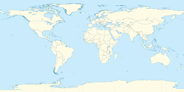
The meridian 90° west of Greenwich is a line of longitude that extends from the North Pole across the Arctic Ocean, North America, the Gulf of Mexico, Central America, the Pacific Ocean, the Southern Ocean, and Antarctica to the South Pole.

In Antarctica, the meridian defines the western limit of Chile's territorial claim. The land further west is not claimed by any nation.

The 90th meridian west forms a great circle with the 90th meridian east.

Starting at the North Pole and heading south to the South Pole, the 90th meridian west passes through:

Co-ordinates Country, territory or sea Notes
90°0′N 90°0′W / 90.000°N 90.000°W / 90.000; -90.000 (Arctic Ocean) Arctic Ocean
81°54′N 90°0′W / 81.900°N 90.000°W / 81.900; -90.000 (Canada)  Canada Nunavut - Ellesmere Island
81°1′N 90°0′W / 81.017°N 90.000°W / 81.017; -90.000 (Nansen Sound) Nansen Sound
80°31′N 90°0′W / 80.517°N 90.000°W / 80.517; -90.000 (Canada)  Canada Nunavut - Axel Heiberg Island
78°17′N 90°0′W / 78.283°N 90.000°W / 78.283; -90.000 (Norwegian Bay) Norwegian Bay
77°22′N 90°0′W / 77.367°N 90.000°W / 77.367; -90.000 (Canada)  Canada Nunavut - Graham Island
77°13′N 90°0′W / 77.217°N 90.000°W / 77.217; -90.000 (Norwegian Bay) Norwegian Bay
76°50′N 90°0′W / 76.833°N 90.000°W / 76.833; -90.000 (Canada)  Canada Nunavut - North Kent Island and Devon Island
74°34′N 90°0′W / 74.567°N 90.000°W / 74.567; -90.000 (Barrow Strait) Barrow Strait
74°4′N 90°0′W / 74.067°N 90.000°W / 74.067; -90.000 (Canada)  Canada Nunavut - Prince Leopold Island
73°59′N 90°0′W / 73.983°N 90.000°W / 73.983; -90.000 (Prince Regent Inlet) Prince Regent Inlet
72°4′N 90°0′W / 72.067°N 90.000°W / 72.067; -90.000 (Canada)  Canada Nunavut - Baffin Island
71°31′N 90°0′W / 71.517°N 90.000°W / 71.517; -90.000 (Gulf of Boothia) Gulf of Boothia
69°7′N 90°0′W / 69.117°N 90.000°W / 69.117; -90.000 (Canada)  Canada Nunavut - Several islands including Helen Island, and the mainland
63°46′N 90°0′W / 63.767°N 90.000°W / 63.767; -90.000 (Hudson Bay) Hudson Bay
57°1′N 90°0′W / 57.017°N 90.000°W / 57.017; -90.000 (Canada)  Canada Manitoba
Ontario
48°3′N 90°0′W / 48.050°N 90.000°W / 48.050; -90.000 (United States)  United States Minnesota
47°49′N 90°0′W / 47.817°N 90.000°W / 47.817; -90.000 (Lake Superior) Lake Superior
46°41′N 90°0′W / 46.683°N 90.000°W / 46.683; -90.000 (United States)  United States Michigan
Wisconsin
Illinois
Missouri
Arkansas
Tennessee - Passing through Memphis
Mississippi
Louisiana - Passing through New Orleans
29°13′N 90°0′W / 29.217°N 90.000°W / 29.217; -90.000 (Gulf of Mexico) Gulf of Mexico
21°10′N 90°0′W / 21.167°N 90.000°W / 21.167; -90.000 (Mexico)  Mexico Yucatán
Campeche
17°49′N 90°0′W / 17.817°N 90.000°W / 17.817; -90.000 (Guatemala)  Guatemala
13°57′N 90°0′W / 13.950°N 90.000°W / 13.950; -90.000 (El Salvador)  El Salvador
13°41′N 90°0′W / 13.683°N 90.000°W / 13.683; -90.000 (Pacific Ocean) Pacific Ocean Passing just west of Genovesa Island and just east of Santa Fe Island, Galápagos,  Ecuador
60°0′S 90°0′W / 60.000°S 90.000°W / -60.000; -90.000 (Southern Ocean) Southern Ocean
72°28′S 90°0′W / 72.467°S 90.000°W / -72.467; -90.000 (Antarctica) Antarctica Border between unclaimed territory and Antártica Chilena Province, claimed by  Chile

See also