Continental Divide of the Americas


The Continental Divide of the Americas (also known as the Continental Gulf of Division, the Great Divide, or merely the Continental Divide) is the principal, and largely mountainous, hydrological divide of the Americas. The Continental Divide extends from the Bering Strait to the Strait of Magellan, and separates the watersheds that drain into the Pacific Ocean from (1) those river systems that drain into the Atlantic Ocean (including those that drain into the Gulf of Mexico and the Caribbean Sea), and (2) along the northernmost reaches of the Divide, those river systems that drain into the Arctic Ocean.
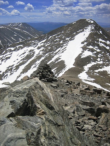
Though there are many other hydrological divides in the Americas, the Great Divide is by far the most prominent of these because it tends to follow a line of high peaks along the main ranges of the Rocky Mountains and Andes, at a generally much higher elevation than the other hydrological divisions.
Geography

Continental Divide of the Americas begins at Cape Prince of Wales, Alaska, the westernmost point on the mainland of the Americas. The Divide crosses northern Alaska into the Yukon, then zig-zags south into British Columbia via the Cassiar Mountains and Omineca Mountains and northern Nechako Plateau to Summit Lake, north of the city of Prince George and just south of the community of McLeod Lake. From there the Divide traverses the McGregor Plateau to the spine of the Rockies, following the crest of the Canadian Rockies southeast to the 120th meridian west, from there forming the boundary between southern British Columbia and southern Alberta.
The Divide crosses into the United States in northwestern Montana, at the boundary between Waterton Lakes National Park and Glacier National Park. In Canada, it forms the western boundary of Waterton Lakes National Park, and in the US bisects Glacier National Park. Further south, the Divide forms the backbone of the Rocky Mountain Front (Front Range) in the Bob Marshall Wilderness, heads south towards Helena and Butte, then west past the namesake community of Divide, Montana through the Anaconda-Pintler Wilderness to the Bitterroot Range, where it forms the eastern third of the state boundary between Idaho and Montana. The Divide crosses into Wyoming within Yellowstone National Park and continues south-east into Colorado where it reaches its highest point in North America at the summit of 4352 m (14,278 ft) Grays Peak. It crosses US Hwy 160 in southern Colorado at Wolf Creek Pass, where a line symbolizes the division. The Divide then proceeds south into western New Mexico. Note that, although the Divide represents the height of land between watersheds, it does not always follow the highest ranges/peaks within each state or province.
In Mexico, it passes through Chihuahua, Durango, Zacatecas, Aguascalientes, Jalisco, Guanajuato, Querétaro, México, the Federal District, Morelos, Puebla, Oaxaca, and Chiapas. In Central America, it continues through southern Guatemala, southwestern Honduras, western Nicaragua, western/southwestern Costa Rica, and southern Panama.
The Divide continues into South America, where it follows the peaks of the Andes Mountains, traversing western Colombia, central Ecuador, western and southwestern Peru, and eastern Chile (essentially conforming to the Chile-Bolivia and Chile-Argentina boundaries), southward to the southern end of Patagonia and Tierra del Fuego.
In North America another, mainly non-mountainous divide, the Laurentian Divide (or Northern Divide), further separates the Hudson Bay-Arctic Ocean drainage region from the Atlantic watershed region. Secondary divides separate the watersheds that flow into the Great Lakes and Saint Lawrence Seaway (ultimately into the Atlantic) from watersheds that flow to the Atlantic via the Missouri-Mississippi complex. Another secondary divide follows the Appalachian chain, which separates those streams and rivers that flow directly into the Atlantic Ocean from those that exit via the Mississippi River.
Triple points
Triple Divide Peak in Glacier National Park, Montana, is the point where two of the principal continental divides in North America converge, the Great Divide and the Northern or Laurentian Divide. From this point, waters flow to the Pacific Ocean, the Atlantic Ocean via the Gulf of Mexico, and the Arctic Ocean via Hudson Bay. Most geographers, geologists, meteorologists, and oceanographers consider this point the hydrological apex of North America.[citation needed] This is not the only place on earth where two oceanic divides meet, i.e., where waters from a single point area feed into three different oceans.[citation needed] This status of Triple Divide Peak is the main reason behind the designation of Waterton-Glacier International Peace Park as the "Crown of the Continent" of North America.[1] Sources differ, however, on whether Hudson Bay is part of the Atlantic or Arctic Ocean. Hudson Bay's waters flow predominantly to the Atlantic and do not directly contribute to the Arctic Ocean.[2]
Another triple divide or triple point occurs in Canada on a prominent peak directly on the border between Alberta and British Columbia, called Snow Dome because the Columbia Icefield completely covers the summit.[3] From this peak, water flows into the Pacific Ocean via the Columbia River system; the Arctic Ocean via the Athabasca River and MacKenzie River systems; and Hudson Bay via the North Saskatchewan River system. Some generally consider Snow Dome the hydrological apex of North America because they consider Hudson Bay an extension of the Atlantic Ocean,[4] and because Snow Dome is 1,000 metres (3,300 ft) higher than Triple Divide Peak and receives considerably more precipitation.[5]
In fact, there are such triple divide points wherever any two continental divides meet.[6] North America can be considered to have five major drainage systems: into the Pacific, Atlantic and Arctic Oceans, plus Hudson Bay and the Gulf of Mexico. Within this system there are four continental divides and three triple points, the two mentioned previously and a third near Hibbing, Minnesota where the Northern Divide intersects the Saint Lawrence Seaway divide.[7] Since there is no true consensus on what a continental divide is, there is no real agreement on where the triple points are.[8] However, the main Continental Divide described in this article is a far more distinctive geological feature than the others and its two main triple points are much more prominent.
Hiking trail
The Continental Divide Trail follows the divide through the U.S. from the Mexican border to the Canadian border. A less-developed Canadian extension called the Great Divide Trail continues through five national parks and six provincial parks, ending at Kakwa Lake in east-central British Columbia.[9]
Exceptions
Many endorheic regions in North America complicate the simple view of east or west, "ocean-bound" water flow. Several endorheic basins appear to straddle the Continental Divide, including the Great Divide Basin in Wyoming, the Plains of San Agustin in New Mexico, the Guzmán Basin in New Mexico and Chihuahua, Mexico, and the Bolsón de Mapimí in Mexico. However, such a basin can be conceptually assigned to one side of the Divide or the other by its lowest perimeter pass; in other words, the proper assignment can be made by determining how the drainage would occur if the basin were to overflow. In line with this, USGS topographic maps show a unique path for the Divide even when a basin is adjacent.
Another kind of exception occurs when a stream falling onto the Divide splits and flows in both directions, or a lake straddling the divide overflows in both directions. Examples of these are, respectively, North Two Ocean Creek and Isa Lake, both located on the Continental Divide in Wyoming. The Panama Canal has this same feature, being man made. The Chagres and Gatun rivers flow into Gatun Lake, which empties to both oceans.
See also
- Continental Divide
- Great Divide Trail
- Great Divide Mountain Bike Route
- Eastern Continental Divide
- List of railroad crossings of the North American continental divide
- Laurentia
- Laurentian Divide (Northern Divide)
References
- ^ [1]
- ^ Lewis, Edward Lyn; Jones, E. Peter (2000). The Freshwater Budget of the Arctic Ocean. Springer. p. 101. ISBN 978-0-7923-6439-9. Retrieved 26 November 2010.
{{cite book}}: Unknown parameter|coauthors=ignored (|author=suggested) (help) - ^ Birrel, Dave (2007). "Snow Dome". Peaks of the Canadian Rockes. PeakFinder (Rocky Mountain Books). Retrieved 2007-12-28.
- ^ Sanford, Robert W. (2010). Our World's Heritage: Creating a Culture Worthy of Place in Canada's Western Mountain Parks. Athabasca University Press. p. 160. ISBN 978-1-897425-57-2.
- ^ Timmer, Henry (2006). "Snow Dome - The Hydrological Apex of North America". Snow Dome. climbwild.net. Retrieved 2007-12-28.
- ^ Andersen, Robert N. (2006). "Triple Divide Points and North American Drainage Basins". University of Wisconsin - Eau Claire. Retrieved 2007-12-29.
- ^ monica driscollian rivers atlas (2006). "Minnesota Rivers Map". Minnesota State Map Collection. Geology.com. Retrieved 2007-12-29.
- ^ Gonzalez, Mark A. (2002). "Continental Divides in North Dakota and North America" (PDF). NGDS Newsletter. North Dakota Geological Survey. Retrieved 2007-12-29.
- ^ Lynx, Dustin (2000). Hiking Canada's Great Divide Trail. Rocky Mountain Books. ISBN 0-921102-79-8.
External links
Definitions from Wiktionary
Media from Commons
News from Wikinews
Quotations from Wikiquote
Texts from Wikisource
Textbooks from Wikibooks
Resources from Wikiversity
- A detailed map of watersheds in North America
- A detailed overview of isolated wetlands from the USFWS
- Detailed article, maps, and boundary data from The National Atlas of the United States
- Parting of the Waters: a creek that flows to two oceans
- U.S. Geological Survey Geographic Names Information System: Continental Divide (New Mexico, Colorado, Wyoming, Idaho, Montana)
- U.S. Geological Survey Geographic Names Information System: Continental Divide (Alaska)
 | ||