Devil's Pocket
Devil's Pocket | |
|---|---|
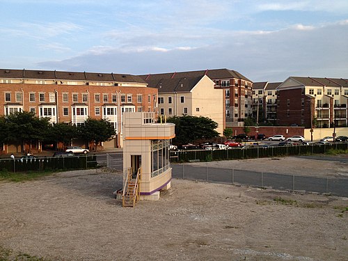 The northern edge of Devil's Pocket is shown to the right of the Naval Square community in this picture | |
| Country | |
| State | Pennsylvania |
| County | Philadelphia County |
| City | Philadelphia |
| Area code | Area code 215 |
Devil's Pocket is a neighborhood in the South Philadelphia section of Philadelphia, Pennsylvania. It is south of Lombard Street, east of 27th Street and north of Washington Avenue,[1] on the western edge of Southwest Center City.
Devil's Pocket is a very small neighborhood of rowhouses tucked near an industrial landscape along the banks of the river. It has historically been heavily Irish-American. The term "Devil's Pocket", not commonly used today, is said to have originated with a priest saying the neighborhood kids were so bad they would steal a chain out of the devil's pocket.[citation needed]
The area north of Bainbridge and west of Gray's Ferry Ave is separated from the remainder of this area by the former Navy Hospital, now Naval Square, a condominium complex developed by Toll Brothers. Unlike the surrounding neighborhoods, this area has not seen dramatic investment and rehabilitation, but has seen some gentrification, and a dilution of the Irish-American populace. Despite the increase in gentrification, however, there remains a large Irish population.
Effects of the Children's Hospital of Philadelphia 2017 Expansion Plans
According to Children's Hospital of Philadelphia's plan to expand into the Schuylkill neighborhood, sources say it is likely that the Devil's Pocket neighborhood will be absorbed into its neighboring community due to the vast nature of the project as it is likely going to make Devil's Pocket indistinguishable from its neighbor.[2]
External links
References
39°56′33″N 75°11′10″W / 39.942493°N 75.18609°W
This Philadelphia County, Pennsylvania state location article is a stub. You can help Wikipedia by expanding it. |