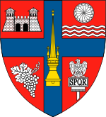
Horoatu Crasnei
Appearance
Horoatu Crasnei | |
|---|---|
 Orthodox Church in Horoatu Crasnei | |
 Commune Horoatu Crasnei in Sălaj County | |
| Country | |
| County | |
| Commune | Horoatu Crasnei |
| Historic region | Transylvania |
| Government | |
| • Mayor | Iosif Şimon (Christian-Democratic National Peasants' Party) |
| Area | 84.39 km2 (32.58 sq mi) |
| Population (2002)[1] | 2,838 |
| Time zone | UTC+2 (EET) |
| • Summer (DST) | UTC+3 (EEST) |
| Website | www.comunahoroatucrasnei.ro |
Horoatu Crasnei (Hungarian: Krasznahorvát) is a commune located in Sălaj County, Romania.
Villages
The commune is composed of four villages: Horoatu Crasnei, Hurez (Bagolyfalu), Stârciu (Bogdánháza) and Şeredeiu (Sereden).
Stârciu
Stârciu is a village in Horoatu Crasnei commune.
In 1910, the village had 1,505 inhabitants: 1,453 Romanians and 25 Hungarians.[2] The first historical accounts of the village was in 1341. Until 1919 the village was part of the Kingdom of Hungary's Szilágy county; it was again part of Hungary during World War II (1940 to 1944).
Sights
- Reformed Church in Horoatu Crasnei, built in the 15th century, historic monument[3]
- Orthodox Church in Horoatu Crasnei, built in the 18th century[4]
References
- ^ Romanian census data, 2002; retrieved on March 1, 2010
- ^ A történelmi Magyarország atlasza és adattára 1914. László Zentai and Pál Kósa. Pécs: Talma Kiadó. 2003. ISBN 963-85683-4-8.
{{cite book}}: CS1 maint: others (link) - ^ welcometoromania.ro - Reformed Church in Horoatu Crasnei, Sălaj County, retrieved on Mai 17, 2012
- ^ welcometoromania.ro - Orthodox Church in Horoatu Crasnei, Sălaj County, retrieved on May 17, 2012
