Larnaca District
34°53′N 33°28′E / 34.883°N 33.467°E
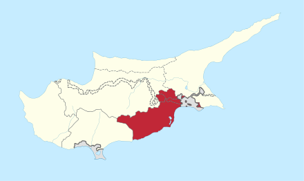
Larnaca District is one of the six districts of Cyprus. Its main town is Larnaca. A small part of the district was occupied by the Turkish army in 1974.
The authorities in Turkish Republic of Northern Cyprus administer the Turkish-controlled parts of Larnaca District as part of Nicosia District.
Located in the district are Larnaca International Airport—the island's most important airport, and Hala Sultan Tekke mosque.
Named after the district is Larnaca District Museum.

This Cyprus location article is a stub. You can help Wikipedia by expanding it. |