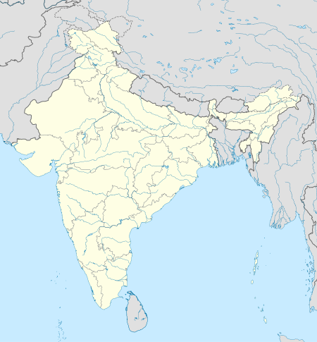
Radhanagar, Sonarpur
Tools
Actions
General
Print/export
In other projects
Appearance
From Wikipedia, the free encyclopedia
This is an old revision of this page, as edited by Dl2000 (talk | contribs) at 20:50, 15 May 2019 (repair template damage). The present address (URL) is a permanent link to this revision, which may differ significantly from the current revision.
Census Town in West Bengal, India
Radhanagar | |
|---|---|
Census Town | |
| Coordinates: 22°26′56″N 88°28′19″E / 22.4488°N 88.4719°E / 22.4488; 88.4719 | |
| Country | |
| State | West Bengal |
| District | South 24 Parganas |
| CD Block | Sonarpur |
| Area | |
| • Total | 5.29 km2 (2.04 sq mi) |
| Elevation | 9 m (30 ft) |
| Population (2011) | |
| • Total | 6,675 |
| • Density | 1,300/km2 (3,300/sq mi) |
| Languages | |
| • Official | Bengali, Hindi, English |
| Time zone | UTC+5:30 (IST) |
| PIN | 700150 |
| Telephone code | +91 33 |
| Vehicle registration | WB-01 to WB-10, WB-19 to WB-22, WB-95 to WB-99 |
| Lok Sabha constituency | Jadavpur |
| Vidhan Sabha constituency | Sonarpur Uttar |
| Website | www |
Radhanagar is a census town under Sonarpur police station of Sonarpur CD Block in Baruipur subdivision of South 24 Parganas district in the Indian State of West Bengal. It is a part of Kolkata Urban Agglomeration.[1]
Geography
Radhanagar town is located at 22°26′56″N 88°28′19″E / 22.4488°N 88.4719°E / 22.4488; 88.4719. It has an average elevation of 9 metres (30 ft).
References
- ^ "Census of India". District-wise list of stautory towns. Directorate of census operations, West Bengal. Archived from the original on 9 August 2007. Retrieved 2 September 2007.
{{cite web}}: Unknown parameter|deadurl=ignored (|url-status=suggested) (help)
South 24 Parganas topics | |||||||||||
|---|---|---|---|---|---|---|---|---|---|---|---|
| General | |||||||||||
| Subdivisions | |||||||||||
| Islands | |||||||||||
| Municipalities | |||||||||||
| Community development blocks |
| ||||||||||
| Archaeological sites | |||||||||||
| Educational institutes of higher learning | |||||||||||
| Rivers | |||||||||||
| Transport | |||||||||||
| Lok Sabha constituencies | |||||||||||
| Vidhan Sabha constituencies |
| ||||||||||
| Former Vidhan Sabha constituencies | |||||||||||
| See also | |||||||||||
| Kolkata Municipal Corporation |
|
|---|---|
| Kolkata Urban Agglomeration Outside KMC |
|
Municipalities and CD blocks of West Bengal | |
|---|---|
| Municipal corporations | |
| Municipalities |
|
| Community development blocks1 |
|
| See also | |
| |
This article about a location in West Bengal is a stub. You can help Wikipedia by expanding it. |
Hidden categories:

