Tobler hyperelliptical projection
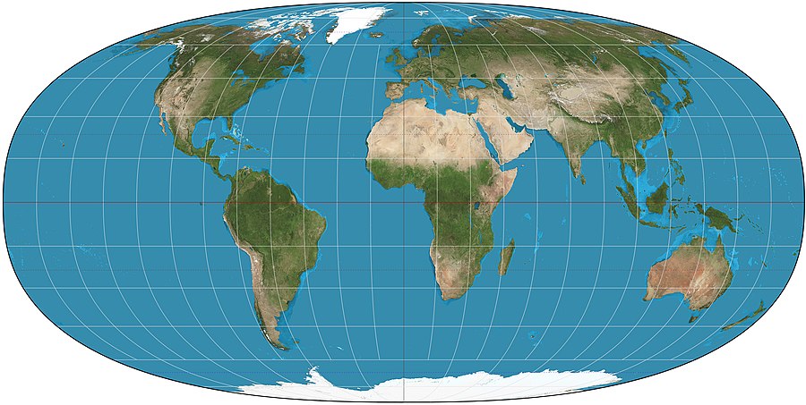
The Tobler hyperelliptical projection is a family of equal-area pseudocylindrical projections that can be used for world maps. Waldo R. Tobler introduced the construction in 1973 as the hyperelliptical projection, usually now known as the Tobler hyperelliptical projection.[1]
Overview
Like any pseudocylindrical projection, in the projection’s normal aspect[2] the parallels of latitude are parallel, straight lines. Their spacing is calculated to provide the equal-area property. Except for the straight central meridian, the meridians of longitude are curves of the form a|x|γ + b|y|γ = 1 (with a dependent on longitude and b constant for a given map), known as superellipses[3] or Lamé curves. When γ=1 the projection degenerates to the Collignon projection; when γ=2 the projection becomes the Mollweide projection; the limiting case as γ→∞ is the cylindrical equal-area projection.[4] Values of γ that are favored by Tobler and others are generally greater than 2.
See also
References
- ^ Snyder, John P. (1993). Flattening the Earth: 2000 Years of Map Projections. Chicago: University of Chicago Press. p. 220.
- ^ The Tobler Hyperelliptical Projection on the Center for Spatially Integrated Social Science's site
- ^ "Superellipse" in MathWorld encyclopedia
- ^ Tobler, Waldo (1973). "The hyperelliptical and other new pseudocylindrical equal area map projections". Journal of Geophysical Research. 78 (11): pp. 1753–1759. Bibcode:1973JGR....78.1753T. doi:10.1029/JB078i011p01753.
{{cite journal}}:|pages=has extra text (help)