Vĩnh Trạch Đông
Vĩnh Trạch Đông | |
|---|---|
 Bạc Liêu windpower farm | |
 Vĩnh Trạch Đông Location in Vietnam | |
| Coordinates: 9°15′35″N 105°47′28″E / 9.25972°N 105.79111°E | |
| Country | |
| Province | Bạc Liêu |
| City | Bạc Liêu |
| Time zone | UTC+07:00 (Indochina Time) |
Vĩnh Trạch Đông is a rural commune (xã) of Bạc Liêu city in Bạc Liêu Province, Vietnam.[1]
References
[edit]- ^ "Administrative subdivisions". General Statistics Office of Vietnam. To find information at reference, go to row 95, then row 954, and it is listed on row 31837.
Capital: Bạc Liêu | ||
| Bạc Liêu | 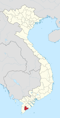 | |
| Giá Rai | ||
| Đông Hải District | ||
| Hòa Bình District | ||
| Hồng Dân District | ||
| Phước Long District | ||
| Vĩnh Lợi District | ||
This article about a location in Bạc Liêu province, Vietnam is a stub. You can help Wikipedia by expanding it. |