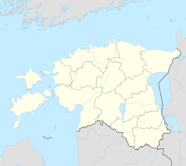
Kergatsi
Appearance
Kergatsi | |
|---|---|
 An image of Kergatsi küla | |
| Coordinates: 57°43′20″N 27°7′31″E / 57.72222°N 27.12528°E | |
| Country | Estonia |
| County | Võru County |
| Municipality | Rõuge Parish |
| Time zone | UTC+2 (EET) |
Kergatsi is a settlement in Rõuge Parish, Võru County in southeastern Estonia.[1] Between 1991–2017 (until the administrative reform of Estonian municipalities) the village was located in Haanja Parish.[2]
References
[edit]- ^ Classification of Estonian administrative units and settlements 2014[dead link] (retrieved 28 July 2021)
- ^ "NGA GeoName Database". National Geospatial-Intelligence Agency. Archived from the original on 2008-06-08. Retrieved 2008-07-09.
External links
[edit]

