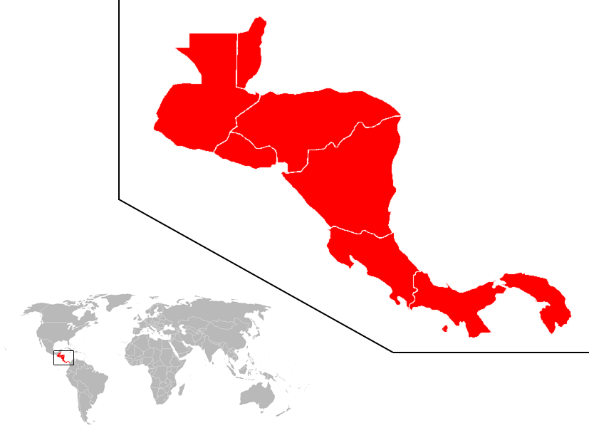
Fichier:Centroamerica-ubicacion.png
Apparence

Taille de cet aperçu : 800 × 581 pixels. Autres résolutions : 320 × 233 pixels | 640 × 465 pixels | 827 × 601 pixels.
Fichier d’origine (827 × 601 pixels, taille du fichier : 61 kio, type MIME : image/png)
Historique du fichier
Cliquer sur une date et heure pour voir le fichier tel qu'il était à ce moment-là.
| Date et heure | Vignette | Dimensions | Utilisateur | Commentaire | |
|---|---|---|---|---|---|
| actuel | 5 septembre 2007 à 19:51 | 827 × 601 (61 kio) | AlexCovarrubias | Mapa más grande, mejor resolución. | |
| 5 septembre 2007 à 17:58 | 467 × 423 (44 kio) | AlexCovarrubias | |||
| 5 septembre 2007 à 17:47 | 1 427 × 628 (38 kio) | AlexCovarrubias | La descripción más extendida de centroamérica es la rep. en este mapa | ||
| 5 septembre 2007 à 16:50 | 251 × 141 (7 kio) | Anjelkaido | ubicación del subcontinente centroamericano, desde el Istmo de Tehuantepec hasta el golfo de Urabá | ||
| 4 septembre 2007 à 15:20 | 1 427 × 628 (38 kio) | AlexCovarrubias | |||
| 22 août 2007 à 16:14 | 800 × 356 (54 kio) | Jcmenal~commonswiki | Centroamérica en el mundo. | ||
| 22 août 2007 à 08:26 | 1 425 × 625 (48 kio) | Joker92~commonswiki | == Sumario == {{Information |Description=Ubucasion de el subcontinente centroamericano en el mundo |Source=http://commons.wikimedia.org/wiki/Image:BlankMap-World.png |Date=28 de junio 2007 |Author=Vardion+dario |Permission=Libre |other_versions= }} == Li | ||
| 28 juin 2007 à 23:33 | 1 425 × 625 (27 kio) | Ruben bardales85~commonswiki | {{Information |Description=Ubucasion de el subcontinente centroamericano en el mundo |Source=http://commons.wikimedia.org/wiki/Image:BlankMap-World.png |Date=28 de junio 2007 |Author=Vardion+dario |Permission=Libre |other_versions= }} |
Utilisation du fichier
Les 25 pages suivantes utilisent ce fichier :
- Catégorie:Amérique
- Page:Amérique/Subdivisions
- Page:Amérique/Subdivisions/1
- Page:Argentine
- Page:Bolivie
- Page:Brésil
- Page:Canada
- Page:Chili
- Page:Colombie
- Page:Cuba
- Page:Guadeloupe
- Page:Guatemala
- Page:Guyane
- Page:Haïti
- Page:Honduras
- Page:Martinique
- Page:Mexique
- Page:Nicaragua
- Page:OTAN
- Page:Pérou
- Page:République dominicaine
- Page:Uruguay
- Page:Venezuela
- Page:Équateur
- Page:États-Unis
Usage global du fichier
Les autres wikis suivants utilisent ce fichier :
- Utilisation sur af.wikipedia.org
- Utilisation sur an.wikipedia.org
- Utilisation sur bn.wikipedia.org
- Utilisation sur en.wikipedia.org
- Belize
- Central America
- El Salvador
- Honduras
- Nicaragua
- Panama
- List of rivers of the Americas
- History of Latin America
- Rail transport by country
- Caribbean Lowlands
- List of islands of Central America
- List of airports in Costa Rica
- Template:Central America topic
- List of airports in Guatemala
- Rail transport in Guatemala
- Rail transport in Honduras
- Rail transport in Belize
- Rail transport in El Salvador
- Rail transport in Costa Rica
- Rail transport in Panama
- Light rail in North America
- List of airports in Belize
- History of rail transport in Nicaragua
- User:AlexCovarrubias/Images
- Streetcars in North America
- List of airports in Panama
- List of airports in El Salvador
- List of airports in Honduras
- List of airports in Nicaragua
- Rail transport in Central America
- List of mammals of Panama
- List of mammals of Nicaragua
- List of mammals of Mexico
- List of mammals of Honduras
- List of mammals of Guatemala
- List of mammals of Greenland
- List of mammals of El Salvador
- List of mammals of Costa Rica
- List of mammals of Belize
- Outline of North America
- Guatemala
- List of ultras of Central America
- User:Rlendog/Sandbox3
- List of mammals of Central America
- Category:Health in Central America
- List of mountain peaks of Central America
Voir davantage sur l’utilisation globale de ce fichier.