[go: nahoru, domu]

Jump to content

Պատկեր:War memorial, Plymouth.jpg

Page contents not supported in other languages.
Վիքիպեդիայից՝ ազատ հանրագիտարանից

Սկզբնական նիշք(402 × 640 փիքսել, նիշքի չափը՝ 102 ԿԲ, MIME-տեսակը՝ image/jpeg)
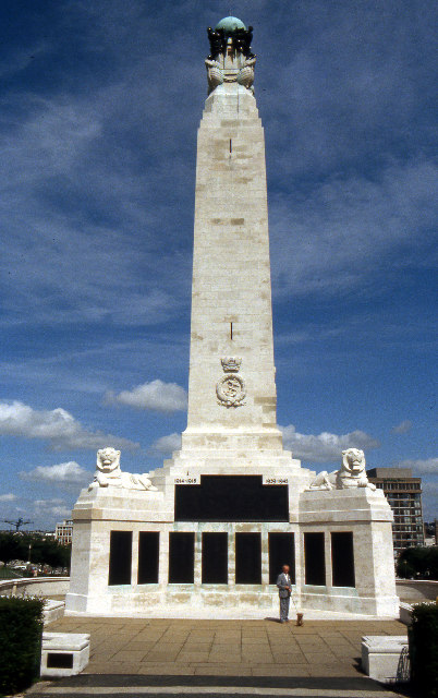
Այս նիշքը տեղադրված է Վիքիպահեստում է և այն կարող է օգտագործվել այլ նախագծերի կողմից։ Վիքիպահեստում նիշքի մասին տեղեկությունների հիմնական մասը ներկայացված է ստորև։

Նկարագրում War memorial, Plymouth Hoe
Թվական
Աղբյուր From geograph.org.uk
Հեղինակ Crispin Purdye
Իրավունքներ
(Նիշքի վերաօգտագործումը)
Creative Commons Attribution Share-alike license 2.0
Տեսախցիկի տեղագրություն50° 21′ 51,66″ Հս. լ., 4° 08′ 33,76″ Ամ. ե. Kartographer map based on OpenStreetMap.Այս և ուրիշ պատկերներ իրենց տեղագրությամբ OpenStreetMapinfo


w:en:Creative Commons
հղում համանման տարածում
This file is licensed under the Creative Commons Attribution-Share Alike 2.0 Generic license.
Հղում: Crispin Purdye
Դուք ազատ եք՝
  • կիսվել ստեղծագործությամբ – պատճենել, տարածել և փոխանցել այս աշխատանքը։
  • վերափոխել – ադապտացնել աշխատանքը
Պահպանելով հետևյալ պայմանները'
  • հղում – Դուք պետք է նշեք հեղինակի (իրավատիրոջ) հղումը:
  • համանման տարածում – Եթե դուք ձևափոխում եք, փոխակերպում, կամ այս աշխատանքի հիման վրա ստեղծում եք նոր աշխատանք, ապա ձեր ստեղծածը կարող է տարածվել միայն նույն կամ համարժեք թույլատրագրով։

Captions

Add a one-line explanation of what this file represents
\u0570\u0578\u0582\u0577\u0561\u0570\u0561\u0574\u0561\u056c\u056b\u0580<\/a>"}},"text\/plain":{"hy":{"P180":"\u0570\u0578\u0582\u0577\u0561\u0570\u0561\u0574\u0561\u056c\u056b\u0580"}}},"{\"value\":{\"entity-type\":\"item\",\"numeric-id\":7205840,\"id\":\"Q7205840\"},\"type\":\"wikibase-entityid\"}":{"text\/html":{"hy":{"P180":"Plymouth Naval Memorial<\/a>\u00a0\u0561\u0576\u0563\u056c\u0565\u0580\u0565\u0576<\/sup>"}},"text\/plain":{"hy":{"P180":"Plymouth Naval Memorial"}}}}" class="wbmi-entityview-statementsGroup wbmi-entityview-statementsGroup-P180 oo-ui-layout oo-ui-panelLayout oo-ui-panelLayout-framed">
\u0540\u056b\u057a\u0565\u0580\u0570\u0572\u0578\u0582\u0574<\/a>"}},"text\/plain":{"hy":{"":"\u0540\u056b\u057a\u0565\u0580\u0570\u0572\u0578\u0582\u0574"}}},"{\"value\":\"https:\\\/\\\/www.geograph.org.uk\\\/profile\\\/2784\",\"type\":\"string\"}":{"text\/html":{"hy":{"P2699":"https:\/\/www.geograph.org.uk\/profile\/2784<\/a>"}},"text\/plain":{"hy":{"P2699":"https:\/\/www.geograph.org.uk\/profile\/2784"}}},"{\"value\":{\"entity-type\":\"property\",\"numeric-id\":2093,\"id\":\"P2093\"},\"type\":\"wikibase-entityid\"}":{"text\/html":{"hy":{"":"\u0570\u0565\u0572\u056b\u0576\u0561\u056f\u056b \u0561\u0576\u0578\u0582\u0576<\/a>"}},"text\/plain":{"hy":{"":"\u0570\u0565\u0572\u056b\u0576\u0561\u056f\u056b \u0561\u0576\u0578\u0582\u0576"}}},"{\"value\":\"Crispin Purdye\",\"type\":\"string\"}":{"text\/html":{"hy":{"P2093":"Crispin Purdye"}},"text\/plain":{"hy":{"P2093":"Crispin Purdye"}}},"{\"value\":{\"entity-type\":\"property\",\"numeric-id\":3831,\"id\":\"P3831\"},\"type\":\"wikibase-entityid\"}":{"text\/html":{"hy":{"":"\u0563\u0578\u0580\u056e\u0578\u0582\u0574 \u0567 \u0578\u0580\u057a\u0565\u057d<\/a>"}},"text\/plain":{"hy":{"":"\u0563\u0578\u0580\u056e\u0578\u0582\u0574 \u0567 \u0578\u0580\u057a\u0565\u057d"}}},"{\"value\":{\"entity-type\":\"item\",\"numeric-id\":33231,\"id\":\"Q33231\"},\"type\":\"wikibase-entityid\"}":{"text\/html":{"hy":{"P3831":"\u056c\u0578\u0582\u057d\u0561\u0576\u056f\u0561\u0580\u056b\u0579<\/a>"}},"text\/plain":{"hy":{"P3831":"\u056c\u0578\u0582\u057d\u0561\u0576\u056f\u0561\u0580\u056b\u0579"}}}}" class="wbmi-entityview-statementsGroup wbmi-entityview-statementsGroup-P170 oo-ui-layout oo-ui-panelLayout oo-ui-panelLayout-framed">
copyrighted<\/a>\u00a0\u0561\u0576\u0563\u056c\u0565\u0580\u0565\u0576<\/sup>"}},"text\/plain":{"hy":{"P6216":"copyrighted"}}}}" class="wbmi-entityview-statementsGroup wbmi-entityview-statementsGroup-P6216 oo-ui-layout oo-ui-panelLayout oo-ui-panelLayout-framed">
Creative Commons Attribution-ShareAlike 2.0 Generic<\/a>\u00a0\u0561\u0576\u0563\u056c\u0565\u0580\u0565\u0576<\/sup>"}},"text\/plain":{"hy":{"P275":"Creative Commons Attribution-ShareAlike 2.0 Generic"}}}}" class="wbmi-entityview-statementsGroup wbmi-entityview-statementsGroup-P275 oo-ui-layout oo-ui-panelLayout oo-ui-panelLayout-framed">
file available on the internet<\/a>\u00a0\u0561\u0576\u0563\u056c\u0565\u0580\u0565\u0576<\/sup>"}},"text\/plain":{"hy":{"P7482":"file available on the internet"}}},"{\"value\":{\"entity-type\":\"property\",\"numeric-id\":137,\"id\":\"P137\"},\"type\":\"wikibase-entityid\"}":{"text\/html":{"hy":{"":"\u057d\u057a\u0561\u057d\u0561\u0580\u056f\u0578\u0572<\/a>"}},"text\/plain":{"hy":{"":"\u057d\u057a\u0561\u057d\u0561\u0580\u056f\u0578\u0572"}}},"{\"value\":{\"entity-type\":\"item\",\"numeric-id\":1503119,\"id\":\"Q1503119\"},\"type\":\"wikibase-entityid\"}":{"text\/html":{"hy":{"P137":"Geograph Britain and Ireland<\/a>\u00a0\u0561\u0576\u0563\u056c\u0565\u0580\u0565\u0576<\/sup>"}},"text\/plain":{"hy":{"P137":"Geograph Britain and Ireland"}}},"{\"value\":{\"entity-type\":\"property\",\"numeric-id\":7384,\"id\":\"P7384\"},\"type\":\"wikibase-entityid\"}":{"text\/html":{"hy":{"":"geograph.org.uk \u057a\u0561\u057f\u056f\u0565\u0580\u056b \u0576\u0578\u0582\u0575\u0576\u0561\u056f\u0561\u0576\u0561\u0581\u0574\u0561\u0576 \u0570\u0561\u0574\u0561\u0580<\/a>"}},"text\/plain":{"hy":{"":"geograph.org.uk \u057a\u0561\u057f\u056f\u0565\u0580\u056b \u0576\u0578\u0582\u0575\u0576\u0561\u056f\u0561\u0576\u0561\u0581\u0574\u0561\u0576 \u0570\u0561\u0574\u0561\u0580"}}},"{\"value\":\"76281\",\"type\":\"string\"}":{"text\/html":{"hy":{"P7384":"76281<\/a>"}},"text\/plain":{"hy":{"P7384":"76281"}}},"{\"value\":{\"entity-type\":\"property\",\"numeric-id\":973,\"id\":\"P973\"},\"type\":\"wikibase-entityid\"}":{"text\/html":{"hy":{"":"\u0576\u056f\u0561\u0580\u0561\u0563\u0580\u057e\u0561\u056e \u0567 \u056f\u0561\u0575\u0584\u0578\u0582\u0574<\/a>"}},"text\/plain":{"hy":{"":"\u0576\u056f\u0561\u0580\u0561\u0563\u0580\u057e\u0561\u056e \u0567 \u056f\u0561\u0575\u0584\u0578\u0582\u0574"}}},"{\"value\":\"https:\\\/\\\/www.geograph.org.uk\\\/photo\\\/76281\",\"type\":\"string\"}":{"text\/html":{"hy":{"P973":"https:\/\/www.geograph.org.uk\/photo\/76281<\/a>"}},"text\/plain":{"hy":{"P973":"https:\/\/www.geograph.org.uk\/photo\/76281"}}}}" class="wbmi-entityview-statementsGroup wbmi-entityview-statementsGroup-P7482 oo-ui-layout oo-ui-panelLayout oo-ui-panelLayout-framed">
Plymouth Hoe<\/a>\u00a0\u0561\u0576\u0563\u056c\u0565\u0580\u0565\u0576<\/sup>"}},"text\/plain":{"hy":{"P1071":"Plymouth Hoe"}}}}" class="wbmi-entityview-statementsGroup wbmi-entityview-statementsGroup-P1071 oo-ui-layout oo-ui-panelLayout oo-ui-panelLayout-framed">

Հուլիս 1980

Նիշքի պատմություն

Մատնահարեք օրվան/ժամին՝ նիշքի այդ պահին տեսքը դիտելու համար։

Օր/ԺամՄանրապատկերՕբյեկտի չափըՄասնակիցՄեկնաբանություն
ընթացիկ12:26, 5 Հուլիսի 200812:26, 5 Հուլիսի 2008 տարբերակի մանրապատկերը402 × 640 (102 ԿԲ)Bsrboy{{Information |Description=War memorial, Plymouth Hoe |Source=From [http://www.geograph.org.uk/photo/76281 geograph.org.uk] |Date=1980-07 |Author=[http://www.geograph.org.uk/profile/2784 Crispin Purdye] |Permission=Creative Commons Attribution Share-alike

Հետևյալ էջը հղվում է այս նիշքին՝

Նիշքի համընդհանուր օգտագործում

Հետևյալ այլ վիքիները օգտագործում են այս նիշքը՝

Մետատվյալներ