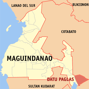
Datu Paglas
Appearance
(Redirected from Datu Paglas, Maguindanao)
| Datu Paglas | |
|---|---|
| Baley na Filipinas | |
 Lokasyon na Datu Paglas | |
 | |
| 6°46′1″N 124°51′0″E | |
| Dalin | Filipinas |
| Angipaletnegan | Nobyembre 22, 1973 |
| Barangay | 23 |
| Kaawang | |
| • Katiponan | 132.10 km2 (51.00 sq mi) |
| Elebasyon | 63 m (207 ft) |
| Bilang na too (Mayo 1, 2020)[1] | |
| • Katiponan | 33,682 |
| • Densidad | 250/km2 (660/sq mi) |
| Economia | |
| • Clase | kumapat ya klase ya baley |
| • Ingresos | ₱154,081,000.0054,035,686.1053,245,765.6560,005,803.84 (2020) |
| • Activos | ₱13,367,000.0097,892,464.53116,798,242.69134,496,263.82166,226,928.11 (2020) |
| • Pasivos | ₱14,162,000.0027,348,596.7223,521,381.2417,784,719.9054,573,350.63 (2020) |
| • Gastos | ₱108,869,000.00 (2020) |
| Kodigo na postal | 9617 |
| Kodigo na lugar | 64 |
Say Datu Paglas et kumapat ya klase ya baley ed luyag na Maguindanao del Sur, Filipinas. Unong ed 1 Mayo 2020 census, say populasyon to et 33,682 totoo tan 5,588 abong. Walay kabaleg tan sukat to ya 132.10 sq. km. Say zip code to et 9617.
Saray barangay
[dumaen | dumaen so pinanlapuan]- Alip (Pob.)
- Bonawan
- Bulod
- Damalusay
- Damawato
- Datang
- Elbebe
- Kalumenga (Kalumanga)
- Katil
- Lipao
- Lomoyon
- Madidis
- Makat
- Malala
- Mangadeg
- Manindolo
- Mao
- Napok
- Palao sa Buto
- Poblacion
- Puya
- Salendab
- Sepaka
Demograpiko
[dumaen | dumaen so pinanlapuan]| Taon | Pop. | ±% p.a. |
|---|---|---|
| 1975 | 6,816 | — |
| 1980 | 8,262 | +3.92% |
| 1990 | 13,970 | +5.39% |
| 1995 | 15,522 | +1.99% |
| 2000 | 20,014 | +5.60% |
| 2007 | 29,979 | +5.73% |
| 2010 | 20,290 | −13.24% |
| 2015 | 28,387 | +6.60% |
| 2020 | 33,682 | +3.42% |
| Reperensiya: Philippine Statistics Authority[2][3][4] | ||
Saray reperensiya
[dumaen | dumaen so pinanlapuan]- ↑ "2020 Census of Population and Housing (2020 CPH) Population Counts Declared Official by the President". Hulyo 7, 2021. https://psa.gov.ph/content/2020-census-population-and-housing-2020-cph-population-counts-declared-official-president.
- ↑ Census of Population (2015). "ARMM – Autonomous Region in Muslim Mindanao". Total Population by Province, City, Municipality and Barangay. PSA. Retrieved 29 June 2016.
- ↑ Census of Population and Housing (2010). "ARMM – Autonomous Region in Muslim Mindanao". Total Population by Province, City, Municipality and Barangay. NSO. Retrieved 29 June 2016.
- ↑ Censuses of Population (1903–2007). "ARMM – Autonomous Region in Muslim Mindanao". Table 1. Population Enumerated in Various Censuses by Province/Highly Urbanized City: 1903 to 2007. NSO.
Saray gawing ed labas
[dumaen | dumaen so pinanlapuan]