[go: nahoru, domu]

Saltar para o conteúdo

Ficheiro:Iran relief location map.jpg

O conteúdo da página não é suportado noutras línguas.
Origem: Wikipédia, a enciclopédia livre.

Imagem numa resolução maior (1 200 × 1 071 píxeis, tamanho: 941 kB, tipo MIME: image/jpeg)

Descrição do ficheiro

Descrição
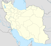
English: Location map of Iran.

Equirectangular projection. Strechted by 118.0%. Geographic limits of the map:

* N: 40.0° N
* S: 24.5° N
* W: 43.5° E
* E: 64.0° E
Made with Natural Earth. Free vector and raster map data @ naturalearthdata.com.
Deutsch: Topografische Karte des Iranischen Hochlandes mit der Verbindung zu Kleinasien im Westen und zum Hindukusch und Himalaya im Osten.
English: Topographic map of the Iranian plateau in Central Asia, connecting to Anatolia in the west and Hindu Kush and Himalaya in the east.
Español: Mapa topográfico de la Meseta iraní. Mapa topográfico de la meseta iraní que enlaza Anatolia en el oeste con el Hindu Kush y el Himalaya en el Este.
Euskara: Irango goi-ordokiaren mapa topografikoa, Anatolia mendebaldean eta Hindu Kush eta Himalaia ekialdean.
فارسی: فلات ایران سرزمین مرتفعی است در همسایگی مناطق کم ارتفاع غرب، شمال و جنوب آسیا.
Français : Carte du plateau iranien en Asie, lié à l'Anatolie à l'ouest, et à l'Hindu Kush et à l'Himalaya à l'est.
한국어: 이란 고원의 서쪽으로는 아나톨리아로 연결되고, 동쪽으로는 힌두쿠시 산맥와 히말라야 산맥과 연결된다.
Nederlands: Kaart van het Hoogland van Iran in Azië, dat zich uitstrekt van Anatolië in het westen tot aan de Hindoekoesj en de Himalaya in het oosten.
Norsk bokmål: Topografisk kart over det iranske høylandet, som grenser til Anatolia i vest og Hindu Kush og Himalaya i øst.
پنجابی: سطح مرتفع ایران دا نقشہ ، لہندے چ اناطولیا تے چڑھدے چ کوہ ہندوکش تے ہمالیہ نال جڑئیا.
Português: Mapa topográfico do planalto iraniano ligando a Anatólia a oeste e o Hindu Kush e os Himalaias a este.
Русский: Иранское нагорье располагается между Аравийским полуостровом на западе и севером Индийского субконтинента на востоке.
Türkçe: Batıda Anadolu'ya doğuda ise Hindukuş ve Himalaya dağlarına bağlanan İran platosunun topografik haritası.
اردو: سطع مرتفع ایران کا نقشہ، مغرب میں اناطولیہ اور مشرق میں ہندوکش اور ہمالیہ سے منسلک.
Tiếng Việt: Bản đồ địa hình với sơn nguyên Iran nối Anatolia ở phía tây với Hindu Kush và Himalaya ở phía đông.
中文:伊朗高原地形圖,連接安納托利亞西部,東與喜馬拉雅山相鄰.
Data
Origem Obra do próprio
Autor Uwe Dedering
Outras versões

Licenciamento

Eu, titular dos direitos de autor desta obra, publico-a com as seguintes licenças:
w:pt:Creative Commons
atribuição partilha nos termos da mesma licença
A utilização deste ficheiro é regulada nos termos da licença Creative Commons - Atribuição-CompartilhaIgual 3.0 Não Adaptada.
Pode:
  • partilhar – copiar, distribuir e transmitir a obra
  • recombinar – criar obras derivadas
De acordo com as seguintes condições:
  • atribuição – Tem de fazer a devida atribuição da autoria, fornecer uma hiperligação para a licença e indicar se foram feitas alterações. Pode fazê-lo de qualquer forma razoável, mas não de forma a sugerir que o licenciador o apoia ou subscreve o seu uso da obra.
  • partilha nos termos da mesma licença – Se remisturar, transformar ou ampliar o conteúdo, tem de distribuir as suas contribuições com a mesma licença ou uma licença compatível com a original.
GNU head É concedida permissão para copiar, distribuir e/ou modificar este documento nos termos da Licença de Documentação Livre GNU, versão 1.2 ou qualquer versão posterior publicada pela Free Software Foundation; sem Secções Invariantes, sem textos de Capa e sem textos de Contra-Capa. É incluída uma cópia da licença na secção intitulada GNU Free Documentation License.
Pode escolher a licença que quiser.

Legendas

Adicione uma explicação de uma linha do que este ficheiro representa
Ir\u00e3o<\/a>"}},"text\/plain":{"pt":{"P180":"Ir\u00e3o"}}}}" class="wbmi-entityview-statementsGroup wbmi-entityview-statementsGroup-P180 oo-ui-layout oo-ui-panelLayout oo-ui-panelLayout-framed">

Elementos retratados neste ficheiro

retrata

protegido por direitos autorais<\/a>"}},"text\/plain":{"pt":{"P6216":"protegido por direitos autorais"}}}}" class="wbmi-entityview-statementsGroup wbmi-entityview-statementsGroup-P6216 oo-ui-layout oo-ui-panelLayout oo-ui-panelLayout-framed">
Licen\u00e7a de Documenta\u00e7\u00e3o Livre GNU, vers\u00e3o 1.2 ou posterior<\/a>"}},"text\/plain":{"pt":{"P275":"Licen\u00e7a de Documenta\u00e7\u00e3o Livre GNU, vers\u00e3o 1.2 ou posterior"}}},"{\"value\":{\"entity-type\":\"item\",\"numeric-id\":14946043,\"id\":\"Q14946043\"},\"type\":\"wikibase-entityid\"}":{"text\/html":{"pt":{"P275":"Creative Commons Atribui\u00e7\u00e3o-CompartilhaIgual 3.0 N\u00e3o Adaptada<\/a>"}},"text\/plain":{"pt":{"P275":"Creative Commons Atribui\u00e7\u00e3o-CompartilhaIgual 3.0 N\u00e3o Adaptada"}}}}" class="wbmi-entityview-statementsGroup wbmi-entityview-statementsGroup-P275 oo-ui-layout oo-ui-panelLayout oo-ui-panelLayout-framed">
cria\u00e7\u00e3o original da(o) volunt\u00e1ria(o) que fez o carregamento<\/a>"}},"text\/plain":{"pt":{"P7482":"cria\u00e7\u00e3o original da(o) volunt\u00e1ria(o) que fez o carregamento"}}}}" class="wbmi-entityview-statementsGroup wbmi-entityview-statementsGroup-P7482 oo-ui-layout oo-ui-panelLayout oo-ui-panelLayout-framed">

image/jpeg

Histórico do ficheiro

Clique uma data e hora para ver o ficheiro tal como ele se encontrava nessa altura.

Data e horaMiniaturaDimensõesUtilizadorComentário
atual20h09min de 11 de julho de 2010Miniatura da versão das 20h09min de 11 de julho de 20101 200 × 1 071 (941 kB)Uwe Dedering31. province Alborz
15h51min de 23 de abril de 2010Miniatura da versão das 15h51min de 23 de abril de 20101 200 × 1 071 (941 kB)Uwe Dedering{{Information |Description={{en|1=Location map of Iran. Equirectangular projection. Strechted by 118.0%. Geographic limits of the map: * N: 40.0° N * S: 24.5° N * W: 43.5° E * E: 64.0° E Made with Natural Earth. Free vector and raster map data @

Utilização global do ficheiro