Datoteka:Outre-mer en.png
Prijeđi na navigaciju
Prijeđi na pretragu
Veličina ovog prikaza: 800 × 400 piksela. Druge rezolucije: 320 × 160 piksela | 640 × 320 piksela | 1.480 × 740 piksela.
Izvorna datoteka (1.480 × 740 piksela, veličina datoteke/fajla: 54 kB, MIME tip: image/png)
Opis izmjene
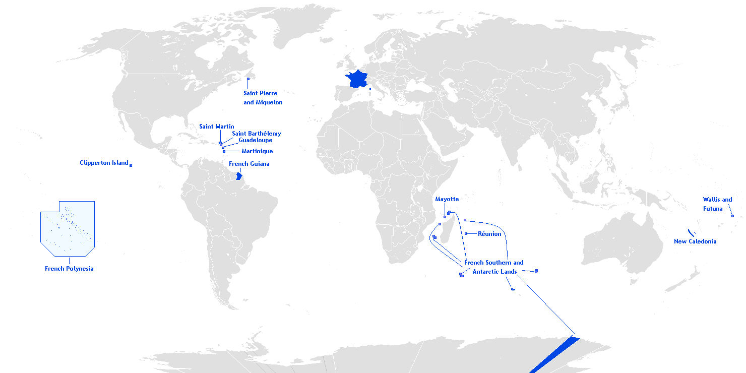
English: This is a translation from esperanto (by Hoshie) into english of User:Manchot sanguinaire's map of French Overseas départements, regions, collectivités, and territories, which is at Image:Outre-mer eo.png. The translations of the names into english are the names used in the CIA World Factbook. I also also added the five Îles Éparses that surround Madagascar. The source for their placement on the map is the CIA Factbook map of the area, which is here on Commons at Image:Iles Eparses-CIA WFB Map.png. The placement of Adélie Land is based upon Image:Antarctica territorial claims.png by User:Astrokey44. Since the original map is GFDL, this one is too.

|
This locator map image could be re-created using vector graphics as an SVG file. This has several advantages; see Commons:Media for cleanup for more information. If an SVG form of this image is available, please upload it and afterwards replace this template with
{{vector version available|new image name}}.
It is recommended to name the SVG file “Outre-mer en.svg”—then the template Vector version available (or Vva) does not need the new image name parameter. |
Licenciranje
Hoshie, vlasnik autorskog prava ovog djela, ovdje ga objavljujem pod sljedećom licencom:

|
Dopušteno je umnožavanje, dijeljenje i mijenjanje ovog dokumenta pod uslovima GNU-ove licence za slobodnu dokumentaciju, verzije 1.2 ili bilo koje novije koju objavi Fondacija za slobodni softver; bez nepromjenljivih odjeljaka i bez tekstova na naslovnoj i zadnjoj strani. Tekst licence možete pročitati ovdje. |
| Ova datoteka dostupna je pod licencom Creative Commons Attribution-Share Alike 3.0 Unported licencom. | ||
| Pripisivanje: Hoshie | ||
| ||
| Ova oznaka licence je dodana na ovu datoteku kao dio GFDL ažuriranja licence. |
Historija datoteke
Kliknite na datum/vrijeme da biste vidjeli tadašnju verziju datoteke.
| Datum/vrijeme | Minijatura | Dimenzije | Korisnik | Komentar | |
|---|---|---|---|---|---|
| aktualna | 22:27, 27 mart 2018 | 1.480 × 740 (54 kB) | Maphobbyist | Upload | |
| 11:12, 28 februar 2016 | 1.480 × 740 (54 kB) | Kontrollstellekundl | Polynesia colour | ||
| 15:15, 24 juli 2013 | 1.480 × 740 (44 kB) | DrKay | remove dark grey areas in Antartica, Dniestr, Kosovo, Palestine, etc. | ||
| 22:41, 12 februar 2012 | 1.480 × 740 (75 kB) | Spesh531 | +south sudan, antarctic territories, other lands, change color of land, fixed boudaries, added accents on e in R e union and Saint Barth e lemy, fixed islands in French Polynesia | ||
| 05:12, 17 decembar 2007 | 1.432 × 742 (58 kB) | Rosss | More accurate shape for French Polynesia | ||
| 04:44, 22 april 2007 | 1.432 × 742 (39 kB) | Kelvinc | fixed shading of antarctica east of adelie land | ||
| 11:59, 17 april 2007 | 1.432 × 742 (26 kB) | Tene~commonswiki | Optimised (0) | ||
| 16:14, 5 mart 2007 | 1.432 × 742 (60 kB) | Hoshie | added Antarctica itself to the image and marked the French claim. The position of St.-Barth and St.-Martin has been fixed | ||
| 20:26, 4 mart 2007 | 1.357 × 628 (53 kB) | Hoshie | removed labels for the Iles Eparses, since they are a part of the TAAF; see http://www.taaf.fr/rubriques/iles/iles_introduction.htm | ||
| 09:11, 2 mart 2007 | 1.357 × 628 (54 kB) | Hoshie | fixed map to include St.-Martin and St.-Barth. |
Upotreba datoteke
Sljedećih 16 stranica koriste ovu datoteku:
- Annam (francuski protektorat)
- Bassas da India
- Europa (otok)
- Francuska Indokina
- Francuska Kočinkina
- Francuska Zapadna Afrika
- Francuski Dahomej
- Francuski protektorat u Kambodži
- Juan de Nova
- Nova Kaledonija
- Saint-Barthélemy
- Tonkin (francuski protektorat)
- Tromelin
- Îles Glorieuses
- Šablon:Bivše francuske kolonije
- Šablon:Francuski prekomorski departmani i teritorije
Globalna upotreba datoteke
Ovu datoteku upotrebljavaju i sljedeći projekti:
- Upotreba na projektu af.wikipedia.org
- Upotreba na projektu ar.wikipedia.org
- Upotreba na projektu as.wikipedia.org
- Upotreba na projektu az.wikipedia.org
- Upotreba na projektu bcl.wikipedia.org
- Upotreba na projektu be.wikipedia.org
- Upotreba na projektu ca.wikipedia.org
- Upotreba na projektu da.wikipedia.org
- Upotreba na projektu de.wikipedia.org
- Upotreba na projektu el.wikipedia.org
- Upotreba na projektu en.wikipedia.org
- Portal:France/Geography
- Portal:France/Administrative divisions
- Template:Infobox European Parliament constituency
- Overseas Territories of France (European Parliament constituency)
- Template:Infobox European Parliament constituency/doc
- Overseas France
- File talk:Outre-mer en.png
- Template:Infobox European Parliament constituency/sandbox
- Upotreba na projektu eo.wikipedia.org
- Upotreba na projektu es.wikipedia.org
- Upotreba na projektu et.wikipedia.org
- Upotreba na projektu eu.wikipedia.org