Temryuk

Temryuk (Russian: Темрю́к) is the largest town on the Taman peninsula in Krasnodar Krai, Russia, located on the right bank of the Kuban River not far from its entry into the Temryuk Bay, amid a field of mud volcanoes. The seaport of Temryuk is situated four kilometers away from the town itself. Population: 36,118 (2002 Census); 26,600 (1975).
Situated in the proximity of the site of ancient Tmutarakan, Temryuk was vied by various powers as a vantage point commanding the mouth of the Kuban River. The first recorded settlement on the site was Tumnev, a Tatar fortress, which passed to the Genoese merchants in the 14th century. It was known as Copa until occupied by the Khanate of Crimea in 1483.
The Russians, allied with a local potentate, Temryuk of Kabarda, captured Tumnev and built a fortress of New Temryuk there. The Crimean Tatars retook the fort in 1570; it was known as Adis for a century to come. In the 18th century the site was settled by the Cossacks, whose stanitsa was incorporated as a town of Temryuk in 1860.
-
Voennaya Gorka, a military vehicle museum on the slope of a mud vulcano in Temryuk.
-
A memorial devoted to the Defense of Temryuk during World War II
-
A WWII motor gun boat on exhibit at Voennaya Gorka
-
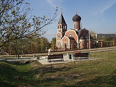
A local Orthodox church


45°16′N 37°23′E / 45.267°N 37.383°E
This Krasnodar Krai location article is a stub. You can help Wikipedia by expanding it. |